
-
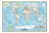
World Classic Wall Map
$16.95
-
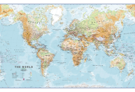
Physical World Wall Map
$33.84
-
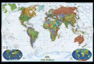
World Decorator Wall Map
$16.95
| Description : World Map in Black and White with Country Names. | Disclaimer |
Features of Black and White World Map with Countries
1. Clear Design: The minimalist design of the map ensures optimal readability, allowing you to effortlessly navigate and explore the boundaries of each country.
2. Country Names: Every country is labeled with its name, making it convenient to identify.
3. High-Quality Image: The provided map image is of the highest quality, offering sharp details and accurate representations of countries and their boundaries.
4. Educational Value: By exploring this black and white world map with countries, you can expand your understanding of global geography and gain valuable insights into the locations and distributions of countries worldwide.
Last Updated on: September 27, 2021