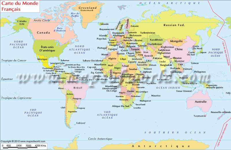
Welcome to our French World Map! Embark on a unique journey as you explore the globe with countries and oceans labeled in the French language. This comprehensive map showcases the world's geographic features in French, offering a distinctive perspective and a deeper immersion into Francophone culture. For an even more expansive collection of maps in French, be sure to visit our subdomain: https://fr.mapsofworld.com/. There, you'll find a wide range of maps specifically designed for our French-speaking users.
Welcome to our French World Map! Embark on a unique journey as you explore the globe with countries and oceans labeled in the French language. This comprehensive map showcases the world's geographic features in French, offering a distinctive perspective and a deeper immersion into Francophone culture. For an even more expansive collection of maps in French, be sure to visit our subdomain: https://fr.mapsofworld.com/. There, you'll find a wide range of maps specifically designed for our French-speaking users.

| Description : This Map depicts countries of the world and water bodies in French language. | Disclaimer |
Explore the Beauty of the French Language
The French language, known for its elegance and global influence, is spoken by millions of people worldwide. Exploring our French World Map not only allows you to appreciate the language's beauty, but also delves into the rich heritage and cultural connections associated with French-speaking countries.
Unveiling the Impact of French Culture
In addition to its linguistic significance, French culture has made remarkable contributions to arts, literature, fashion, gastronomy, and diplomacy. From timeless literary classics like Victor Hugo's "Les Misérables" to the world-renowned cuisine and culinary traditions of France, the French language has played a pivotal role in shaping global culture.
Related links
France Map
France on World Map
French Speaking Countries
French Language
French Polynesia Map

