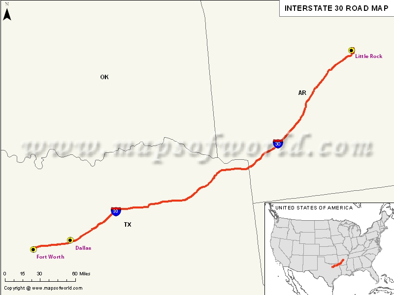
USA Interstate 30 Map

| Description:Map depicts US Interstate 30 (I-30) route from Fort Worth, Texas (I-20) to North Little Rock, Arkansas. | Disclaimer |
×
Disclaimer : All efforts have been made to make this image accurate. However MapSherpa, Inc, its directors and employees do not own any responsibility for the correctness or authenticity of the same.
US Interstate 30 highway Map
Interstate 30, popularly abbreviated as I-30 is an Interstate Highway situated in the southern United States. It is comparatively short regional route that serve only two US states.
I-30 is also considered as the shortest two-digit interstate ending in zero in the Interstate highway system. On the contrary, Interstates ending in 0 are usually the longest east-west Interstates. This Interstate 30 is also the second shortest major Interstate after Interstate 45.
Extent of I-30 Highway
Interstate 30 stretches from Interstate 20 west of Fort Worth, Texas, northeast via Dallas, and Texarkana, Texas to Interstate 40 in North Little Rock in Arkansas. This route is in parallel to the US Route 67 except for the west of downtown Dallas, which was once a component of Interstate 20. Interstate 30 intersects with two of the 10 major north-south Interstates and also with the major Interstate routes including I-20 and I-40. Also known as the Tom Landry Freeway, Interstate 30 lies between I-35W and I-35E.States and cities along I-30 Highway
- Arkansas: Little Rock(N. Little Rock), Texarkana
- Texas: Dallas-Ft. Worth-Arlington
Restaurants along Interstate-30 Highway
Here is a list of few great restaurants along Interstate-30 Highway:
- 4 Horse Cantina
- Edelweiss
- Japanese Palace
- Spring Creek Barbeque
- Taco Casa
Attractions along I-30 Highway
Some of the renowned tourist attractions along I-30 Highway include:
- Atlanta State Park
- Lake Catherine State Park
- Tnt Racing
- Turner & Runyon Gallery
- Trinity Park
Route of Interstate Highway No.30 |
|---|
| State | Entry Point | Exit Point | Length |
|---|---|---|---|
| Texas | Fort Worth, TX | Texarkana, TX | 223.74 mi (360.07 km) |
| Arkansas | Hope, AR | North Little Rock, AR | 143.02 mi (230.17 km) |
| Total Length | 366.76 mi (590.24 km) |
US Interstates Highways Route Map |
|---|

