United States Divided into Physical Regions

| Description : The Map showing the various physical regions of the United States. |
The United States, in the geographical sense, is commonly showed as the contiguous US which has 48 states. The states of Alaska and Hawaii are outside of the contiguous United States.
Each region has distinct culture, history, climate, and geographic features, and more.
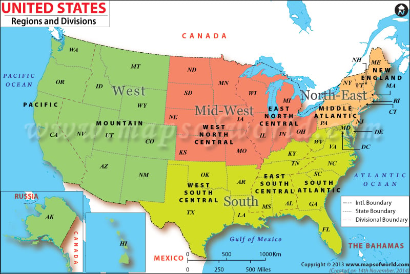
First map of the contiguous US shows four geographic regions: the East Coast, Midwest, South, and West.
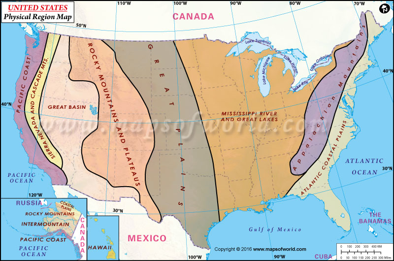
The second map depicts physical regions of the country which are: Atlantic Coastal Plains, Appalachian Mountains, Great Lakes and Great Rivers Basin, Great Plains, Rocky Mountains and Plateaus, Great Basin, Sierra Nevada and Cascades Mountains, and the Pacific Coast.
According to US Census Bureau, each of the four census regions is further divided into two or more census divisions. See table below –
ACOD~20121005
Regions of United States |
|---|
Region 1 (The Northeast) |
|
|---|---|
| Division 1 (New England) | Division 2 (Middle Atlantic) |
| Maine | New York |
| New Hampshire | Pennsylvania |
| Vermont | New Jersey |
| Massachusetts | |
| Rhode Island | |
| Connecticut | |
Region 2 (The Midwest) |
|
| Division 3 (East North Central) | Division 4 (West North Central) |
| Wisconsin | North Dakota |
| Michigan | South Dakota |
| Illinois | Nebraska |
| Indiana | Kansas |
| Ohio | Minnesota |
| Iowa | |
Region 3 (The South) |
|
| Division 5 (South Atlantic) | Division 6 (East South Central) |
| Delaware | Kentucky |
| Maryland | Tennessee |
| District of Columbia | Mississippi |
| Virginia | Alabama |
| West Virginia | |
| North Carolina | Division 7 (West South Central) |
| South Carolina | Oklahoma |
| Georgia | Texas |
| Florida | Arkansas |
| Louisiana | |
Region 4 (The West) |
|
| Division 8 (Mountain) | Division 9 (Pacific) |
| Idaho | Alaska |
| Montana | Washington |
| Wyoming | Oregon |
| Nevada | California |
| Utah | Hawaii |
| Colorado | |
| Arizona | |
| New Mexico | |
