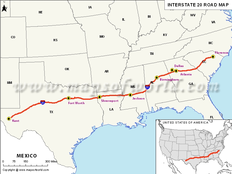
Interstate 20 Map, USA
US Interstate 20 Map

| Description:The Map depicts US Interstate 20 (I-20) route from Kent, Texas to Florence, South Carolina. | Disclaimer |
×
Disclaimer : All efforts have been made to make this image accurate. However MapSherpa, Inc, its directors and employees do not own any responsibility for the correctness or authenticity of the same.
US Interstate 20 Highway
The Interstate-20 Highway extends from western Texas to the southeastern state of North Carolina. One look at the US Interstate Highway Map makes you realize that it's a major east-west link running for 1,535 miles (2,470 km).
Being one of the biggest interstate highway systems in the US, the I-20 begins near Kent in Texas and terminates in Florence in the South Carolina state. The westernmost part of the Interstate 20 passes through some scarcely populated areas with segregated terrain. The speed limit along the 89-mile stretch connecting IH 10 and Monahan is 80 miles per hour.
Commuters intending to use the interstate highway are advised to be prepared to face very slow traffic due to the closure of several lanes. The resurfacing of the interstate highway will be done on the east and west adjoining lanes along the 15 miles of the highway linking the Sweetwater Creek just past Thornton Road and the Hill Street.
Travelers using this major highway can stop over at popular restaurants and fast food joints. Arlington Highland, located along the interstate-20 Frontage Road, is known to have a shopping plaza with several other dining alternatives. Stanleo's, located along the Walton way in Augusta, is also a good place to have breakfast. Several tourist attractions worth visiting are located along the Interstate 20 highway.
Around the Mississippi area lies the famous Vicksburg historical site for travelers to explore. Along this major highway, there are a number of gas and service stations which can be of of great help to the travelers. A good example is the Wal-mart Supercenter, which offers all kinds of car services under one roof.
Route of Interstate Highway No.20 |
|---|
| State | Entry Point | Exit Point | Length |
|---|---|---|---|
| Texas | Toyah, TX | Waskom, TX | 636.08 mi (1,023.67 km) |
| Louisiana | Greenwood, LA | Delta, LA | 189.87 mi (305.57 km) |
| Mississippi | Vicksburg, MS | Meridian, MS | 154.5 mi (248.6 km) |
| Alabama | Tuscaloosa, AL | Tallapoosa River, AL | 213 mi (343 km) |
| Georgia | Villa Rica, GA | Augusta, GA | 202.61 mi (326.07 km) |
| South Carolina | North Augusta, SC | Florence, SC | 141.51 mi (227.74 km) |
| Total Length | 1,539.38 mi (2,477.39 km) |
US Interstates Highways Route Map |
|---|

