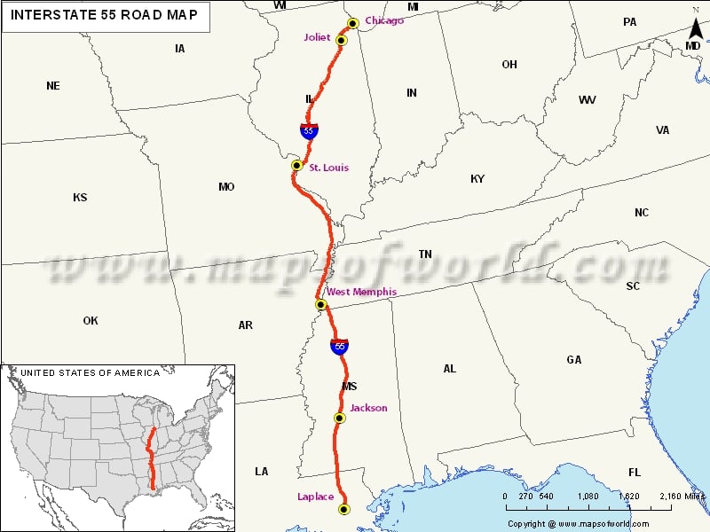
USA Interstate 55 Map

| Description:Map depicts US Interstate 55 (I-55) route from Laplace, Louisiana to Chicago, Illinois. | Disclaimer |
×
Disclaimer : All efforts have been made to make this image accurate. However MapSherpa, Inc, its directors and employees do not own any responsibility for the correctness or authenticity of the same.
The US Interstate 55 Highway
The US interstate highway map shows the location of Interstate 55 highway in the central US. It is a crucial part of the interstate highway system. I-55, as it is commonly abbreviated, begins in Laplace, (Louisiana) and stretches all the way to upwards Chicago at the McCormick Place. It is important to note that part of the interstate 55, linking Chicago and St. Louis, was constructed as a bypass for the United States Interstate 66 highway.
This major highway is known to be the only one of all the interstate highways that intersects the famous Mississippi River twice. One of the intersections is in St, Louis (Missouri) and the other one is in Memphis (Tennessee).
Major cities along I-55 Highway
There are several major cities that stand along the US Interstate 55, including Chicago, Bloomington, and Springfield – all located in the state of Illinois. The famous Blytheville (Arkansas), Grenada, Hernando and Jackson (Mississippi), and New Orleans and Hammond (Louisiana) are the main cities where commuters can stop over.
Hotels and Restaurants along I-55 Highway
There also several hotels and restaurants located along the Interstate 55. In Memphis, hotels such as Knights Inn, Budgettel Inn& Suites, Roadway Inn and Colonial Inn can serve best to those commuters who need a breather or a place to lodge. Morte Carlo Motel, Auberge Nouvelle and Motel 6 – all in New Orleans – are other places along the highway where you can stop and relax for a while.Attractions along I-55 Highway
As a traveler along this highway, you can enjoy a piece of historical attraction in the form of the National Ornamental Metal Museum and Durden Gallery in Memphis. You can also be treated with beautiful, serene views of the Horseshoe Lake State Park and Cahokia Mounds State Historic site – both located in the state of Illinois.Route of Interstate Highway No.55 |
|---|
| State | Entry Point | Exit Point | Length |
|---|---|---|---|
| Louisiana | LaPlace, LA | Kentwood, LA | 65.81 mi (105.91 km) |
| Mississippi | McComb, MS | Southaven, MS | 290.41 mi (467.37 km) |
| Mississippi-Tennessee state line | Mississippi-Tennessee state line | Arkansas state line | 12 mi (19 km) |
| Tennessee state line, AR | Tennessee state line, AR | Missouri state line, AR | 72.22 mi (116.23 km) |
| Arkansas state line, MO | Arkansas state line, MO | East St. Louis, MO | 210.45 mi (338.69 km) |
| Illinois | East St. Louis, IL | Chicago, IL | 294.38 mi (473.76 km) |
| Total Length | 964.25 mi (1,551.81 km) |
US Interstates Highways Route Map |
|---|

