- California Counties - California County Map, Maps of California Counties
- Major Cities of California - San Jose, Santa Barbara, Santa Cruz, Fresno, Los Angeles, Monterey, Palm Springs, Redding, Riverside, Sacramento, San Francisco, Anaheim, Bakersfield, Central San Francisco
- Neighbouring States - Oregon, Nevada, Arizona
- Regional Maps - Map of USA
- Other California Maps - California Map , Where is California , California Airports Map, California Lat Long Map, California Zip Code Map, California Area Code Map, California National Parks Map
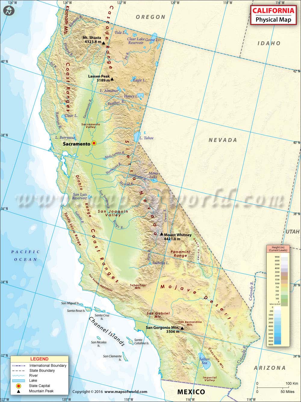
Physical features of California
California is the third largest state in the United States in terms of area. The entire state is often geographically divided into the Southern California and the Northern California region. While 10 southernmost counties make up Southern California, the northern part comprises the 48 northernmost counties.
The California Central Valley is the most cultivable agricultural heartland and is located in the middle of the state. It is bordered by Sierra Nevada, which is located to its east, the coastal mountain ranges to the west, the Cascade Range to the north and the Tehachapi Mountains in the south. The Sacramento-San Joaquin River Delta forms a critical supply hub for California. Off the Southern coast are the Channel Islands. The heights peak in the contiguous states is the Mount Whitney. With a height of 14,505 feet, it forms a part of the Sierra Nevada. Other attractions that one can find in Sierra Nevada are the Yosemite Valley, Sequoia National Park, and Lake Tahoe. Owens Valley and Mono Lake are located to the east of Sierra Nevada and in the western part is Clear Lake. Among the many glaciers found here the most prominent one is Palisade Glacier.
With forests covering around 45 percent of the area of the state, many of the trees that are situated in the California White Mountains are said to be the world’s oldest. California is also home to the Salton Sea, which is a large inland lake; Death Valley, the hottest place in North America; the desert Mojave; and the Badwater Basin.
 Wall Maps