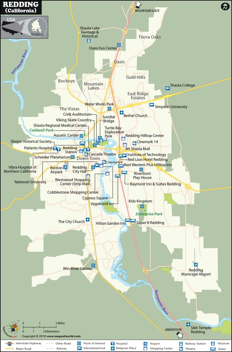
Redding is situated on the Interstate 5 south of Shasta Lake. It is the largest city in the north of Sacramento. This metropolitan area is the center of many functions of California. Currently the population of this city is 104,295.
The geographical coordinates of the Redding are 40 degree 34′ 36″ N and 122 degrees 22′ 13″ W. The total area this city covers is 154.4 km among which 151.4 km is occupied by land and 3.1 km of it is water. The city enjoys a Mediterranean climate. The summers are extremely hot and the winters are wet.
City of Redding has got a number of rare and endangered species. The flora and fauna of this city are really of great interest. This city comes under the PST (UTC-8) time zone. But in summer the standard time is UTC-7.
Redding of California has got an interesting history as well. It was occupied by Wintu tribe of Native Americans. Some members of the US exploring Expedition passed through this city. Pierson B. Reading was the first non-native settler. Previously it was not a prosperous town. Being founded by miners it was known as Poverty Flats. It was named Redding for Benjamin B. Redding. The city underwent many ups and downs and finally acquired stability.
Redding of California includes a lot of attractions like :
- Sundial Bridge
- Turtle Bay Exploration Park
- Sacramento River Trail
- Shasta State Historic Park
- Win-River Casino
- Water Works Park
- Sacramento River
- Old City Hall Arts Center
Redding is a nice place with a rich culture, vibrant population and wonderful natural beauties.
- Name : Guesthouse Hotel & Suites
- Address : 801 Imperial Ave,
Calexico, CA 92231
- Rating : Three Star (***)
- Prices : In American Dollars
- Check in : 01:00 PM
- Check out : 12:00 PM
- Phone : 1-877-477-5817

