US States Location Maps
- Alabama
- Alaska
- Arizona
- Arkankas
- Colorado
- California
- Connecticut
- Delaware
- Florida
- Georgia
- Hawaii
- Idaho
- Illinois
- Indiana
- Iowa
- Kansas
- Kentucky
- Louisiana
- Maine
- Maryland
- Massachusetts
- Michigan
- Minnesota
- Mississippi
- Missouri
- Montana
- Nebraska
- Nevada
- New Hampshire
- New Jersey
- New Mexico
- New York
- North Carolina
- North Dakota
- Ohio
- Oklahoma
- Oregon
- Pennsylvania
- Rhode Island
- South Carolina
- South Dakota
- Tennessee
- Texas
- Utah
- Vermont
- Virginia
- Washington
- West Virginia
- Wisconsin
- Wyoming
Search U.S. City Location
| Email This Link | Save |
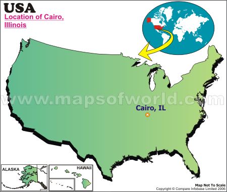
| Location: | Cairo, IL. |
| Latitude: | 37.00N |
| Longitude: | 89.11W |
Disclaimer : All efforts have been made to make this image accurate. However MapSherpa, Inc, its directors and employees do not own any responsibility for the correctness or authenticity of the same.
Cairo is the county seat of Alexander County, in the state of Illinois, USA. This city got its name after the name of the city (Cairo) in Egypt. It is in the Central Standard time zone and lies at an elevation of 322 feet. Cairo city is located at the southernmost tip of the state of Illinois where Ohio River flows into the Mississippi River. Due to its location, it is of strategic importance both economically as well as militarily The Ulysses S Grant was headquartered here in 1861. Cairo was founded in 1837 by the Cairo City and Canal Company, and incorporated as a city in 1858.
Cairo is surrounded by sixty foot high levee walls on all sides to protect it from the rampaging rivers. In the later half of the 19th century and the early 20th century, it was a major shipping port and the economic center of the region. The city park (named Fort Defiance State Park), at the point where the two rivers meet, was once the location of Fort Defiance. Some of the other historic buildings and locations which are an indespensable part of Cairo tourism are Magnolia Manor, the Riverlore, Gem Theatre, The Cairo Custom House, AB Safford Memorial Library, The Hewer, etc.
One can find befitting accomodation in hotels in Cairo or in places situated close to it. Days Inn Hotel is one of the best Cairo hotels and is located at the confluence of the Ohio and the Mississippi Rivers. One can also look for rooms in the Comfort Inn Charleston, Econo Lodge, etc. located at some distance from the city center.
Cairo restaurants like the Cairo Truck Plaza & Restaurant, Nonnys, The Lunch Box, Bettys, Kays, etc. serve a variety of American and Asian cuisines.
One can plan to spend ones holidays in Cairo and have a memorable time. St Louis International Airport at a distance of 20 miles, Princeton Caldwell County Airport at a distance of 31.9 miles, Mayfield Graves County airport at a distance of 38.1 miles, from Cairo are the nearest airports where any flight to Cairo might lead. From here one can hire a car to Cairo city center.
|


