- Hawaii Counties - Hawaii County Map, Map of Hawaii Counties
- Major Cities of Hawaii - Honolulu, Maui City, Lahaina, Hilo, Lihue
- Neighbouring States - California, Arizona, Nevada, Utah
- Regional Maps - Map of USA
- Other Hawaii Maps - Hawaii Map, Hawaii Physical Map, Hawaii Airports Map, Hawaii Lat Long map, Hawaii Zip Code Map, Hawaii Area Code Map, Hawaii National Parks Map
Where is Hawaii?
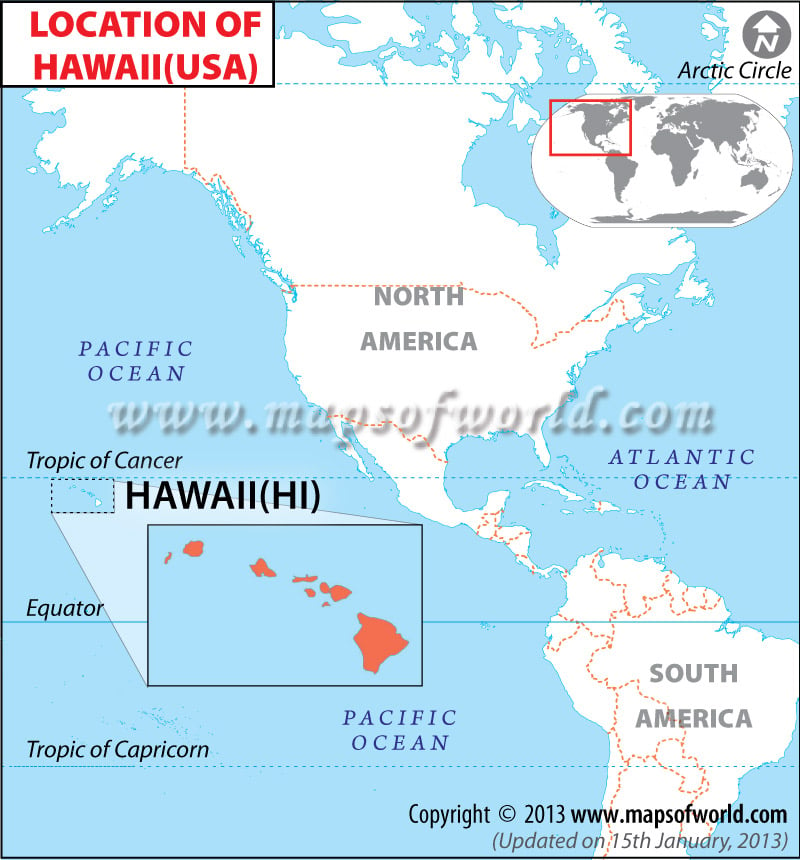
Location of Hawaii
Though Hawaii is part of the United States, it is a chain of islands located about 3,200 kilometers (2,000 miles) from the continental United States, out in the middle of the Pacific Ocean. Hawaii is the southernmost of the United States, and the Aleutian Islands of Alaska are the only part of the United States that extend farther west than Hawaii. Hawaii’s location also makes it the only state not located in North America.
As an island state, Hawaii does not share any borders with other states or countries. Hawaii is made up of eight main islands: Hawaii, Maui, Oahu, Kahoolawe, Lanai, Molokai, Kauai, Niihau. Smaller islands are also part of the state, of which there are more than 100, include Ka’ala.
Facts About Hawaii |
|---|
| City Name | Hawaii |
|---|---|
| Country | US State |
| Capital and Largest City | Honolulu |
| Area | 10,931 sq mi (28,311 km2) , % water 41.2 |
| Population | 1,419,561 (2014 est) |
| Lat Long | 21.311389, -157.796389 |
| Official Language | English, Hawaiian |
| Calling Code | +1 808 |
| Time Zone | Hawaii: UTC −10 (no DST) |
| Airport | 28, (Honolulu International Airport ) |
| Internet TLD | – |
| Currency | US Dollar |
 Wall Maps