Latitude and Longitude Maps of African Countries
Africa's latitude and longitude lies between 9.1021° N, 18.2812° E. It covers a total land area of almost 30.2 million square kilometers (11.7 million square miles) which is more than one-fifth of the world's land area.

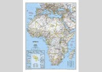
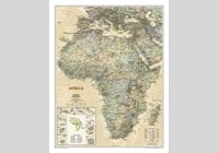
| Description : The map of Africa continent showing international boundaries with islands, countries latitudes and longitudes plotted on it. | Disclaimer |
×
Disclaimer : All efforts have been made to make this image accurate. However MapSherpa, Inc, its directors and employees do not own any responsibility for the correctness or authenticity of the same.


