- New York Counties - New York County Map, Map of New York Counties
- Major Cities of New York - Queens City, Manhattan, Brooklyn, Albany, Central New York, New York City Boroughs
- Neighbouring States - Pennsylvania, Connecticut, New Jersey, Massachusetts, Vermont
- Regional Maps - Map of USA
- Other New York Maps - New York Map, New York Physical Map, New York Airports Map, New York Lat Long Map, New York Zip Code Map, New York Area Code Map, New York National Parks Map
Location of New York on Map
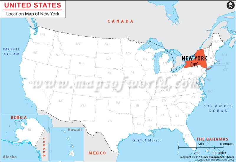
The New York location map clearly defines the accurate geographical position of the state. New York is the 27th biggest state in the United States. New York is located in the northeastern part of the United States of America.
The state shares its northwestern and northern border with Quebec and Ontario of Canada, eastern border with Massachusetts, Vermont and Connecticut, southern border with New Jersey, Pennsylvania and the Atlantic Ocean and western border with Ontario and Pennsylvania. The length of the boundary of New York is 2,301 km.
The state of New York is an important segment of the northeastern United States. It lies in the Mid-Atlantic Census Bureau division. The area of New York is 54,556 square miles (141,299 km) and it is the 27th biggest state in the U.S. in terms of size. The state is bounded by six American states: New Jersey and Pennsylvania to the south, and Rhode Island (over Long Island Sound), Connecticut, Vermont, and Massachusetts to the east. Two Canadian provinces in the north – Quebec and Ontario are also bounded by New York. Furthermore, the Atlantic Ocean edges the state to the southeast, and two of the Great Lakes, Lake Ontario and Lake Erie edges it to the northwest and west respectively.
Facts About New York |
|---|
| City Name | New York |
|---|---|
| Country | USA |
| Continent | North America |
| Capital | Albany |
| Largest city | New York City |
| Area | 54,555 sq mi (141,300 km2) |
| Population | 19,746,227 (2014 est) |
| Lat Long | 43° 0′ 0″ N, 75° 0′ 0″ W, (43, -75) |
| Official Language | None, (Spoken Language -English (only) 72%, Spanish 14%, Others 14% ) |
| Calling Code | 00 1 212 X |
| Time Zone | Eastern: UTC -5/-4 |
| Airport | 68 Airports |
| Neighbour countries | Canada, Vermont, Massachutchetts, Pennyslyvania, New Jersey, and Connecticut. |
| Internet TLD | .nyc |
| Currency | U.S. dollar |
