7.1K
- Iowa Counties - Iowa County Map, Map of Iowa Counties
- Major Cities of Iowa - Des Moines, Waterloo
- Neighbouring States - Minnesota, Wisconsin, Illinois, Missouri, Nebraska, South Dakota
- Regional Maps - Map of USA
- Other Iowa Maps - Iowa Map, Iowa Physical Map, Iowa Airport Map, Iowa Lat Long Map, Iowa Zip Code Map, Iowa Area Code Map
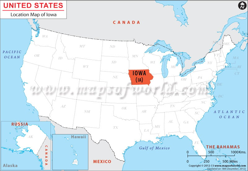
The total area occupied by Iowa is 56,276 sq mi. South Dakota and Nebraska border the state on the west, whereas Illinois and Wisconsin share the eastern border of Iowa. Minnesota is to the north of the state, while Missouri borders the state on the south.
Iowa is situates at the coordinates 42.0° N, 93.0° W. South Dakota and Nebraska border the state on the west, whereas Illinois and Wisconsin share the eastern border of Iowa. Minnesota is to the north of the state, while Missouri borders the state on the south.
Facts About Iowa |
|---|
| State Name | Iowa |
|---|---|
| Country | USA |
| Continent | North America |
| Capital and largest city | Des Moines |
| Area | 56,272 sq mi (145,743 km2) |
| Population | 3,107,126 (2014 est) |
| Lat Long | 42° 0′ 0″ N, 93° 0′ 0″ W |
| Official Language | English |
| Calling Code | 00 1 515 X |
| Time Zone | Central: UTC -6/-5 |
| Airport | 8- Airports in Scheduled service |
| Neighbour State | Minnesota, Wisconsin, Illinois, Missouri, Nebraska, South Dakota |
| Internet TLD | |
| Currency | United States dollarb (USD) |
 Wall Maps