- Montana Counties - Montana County Map, Map of Montana Counties
- Major Cities of Montana - Helena
- Neighbouring States - South Dakota, North Dakota, Wyoming, Idaho
- Regional Maps - Map of USA
- Other Montana Maps - Montana Map, Montana Physical Map, Montana Airports Map, Montana Lat Long Map, Montana Zip Code Map, Montana Area Code Map, Montana National Parks Map
The state of Montana covers a total area of 147,046 sq miles, with cities like Helena, Great Falls, Billings, Bozeman, Butte, Kalispell arrayed in the 56 counties throughout.
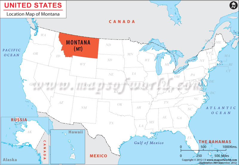
Neighbor to South and North Dakota on the east, the state shares its northern border with the Canadian states of Saskatchewan, Alberta and British Columbia. Idaho abuts Montana on the west, and both Wyoming and Idaho share the southern border of Montana.
The geographical location of Montana is 47.0° N and 110.0° W. Neighbor to South and North Dakota on the east, the state shares its northern border with the Canadian states of Saskatchewan, Alberta and British Columbia. Idaho abuts Montana on the west, and both Wyoming and Idaho share the southern border of Montana.
Locations in the Map
NEIGHBOUR COUNTRIES:
Canada, Mexico.
SEAS, OCEANS, RIVER, BAY:
Gulf of Mexico, Pacific Ocean, Atlantic Ocean
Facts About Montana
| State Name | Montana |
|---|---|
| Continent | North America |
| Country | United States (USA) |
| Capital | Helena |
| Largest city | Billings |
| Area | 147,040 sq mi (380,800 km2) |
| Population | 1,023,579 (2014 est) |
| Lat Long | 47° 0′ 0″ N, 110° 0′ 0″ W |
| Official Language | English |
| Calling Code | 00 1 406 X (Helena), 00 1 406 X (Billings) |
| Time Zone | Mountain: UTC -7/-6 |
| Airport | 13- Airports (Commercial Service) |
| Neighbour State | Wyoming, North Dakota, Idaho, South Dakota |
| Internet TLD | NA |
| Currency | United States Dollar (USD) |
 Wall Maps