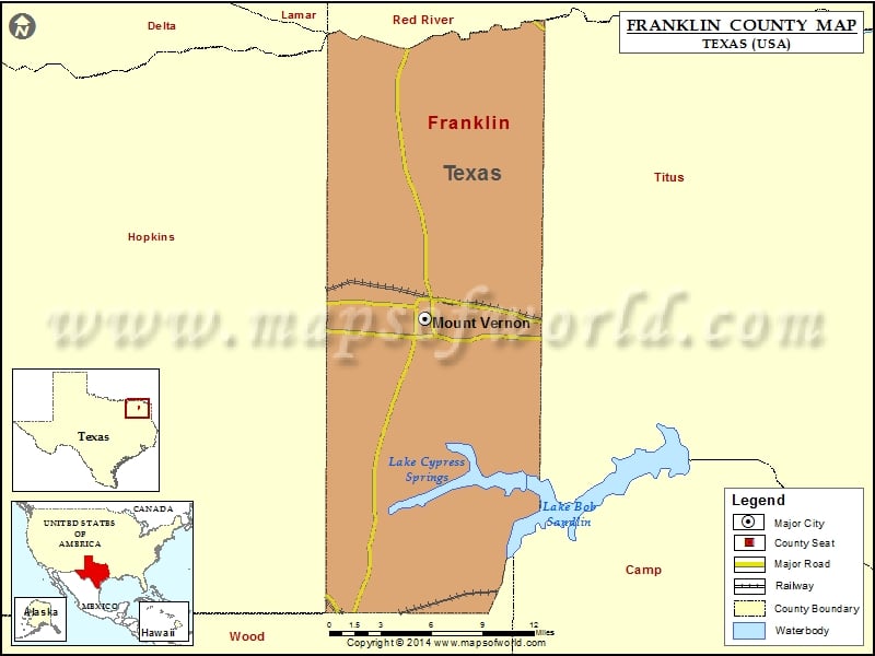
About Franklin County
Franklin County is a county located in the northeastern part of the state of Texas, and its county seat is Mount Vernon. The area is known for its rich history, with landmarks such as the Old Fire Station Museum and the Sam Rayburn House Museum. The county is also home to several parks and natural areas, including Lake Bob Sandlin State Park and Cooper Lake State Park. The Franklin County map shows major highways and transportation networks that connect the area to other parts of Texas and the United States. The region offers a high quality of life with excellent schools, parks, and cultural amenities, and is a popular destination for outdoor recreation and entertainment.
Airports in Franklin County
| Airport Name |
|---|
| Franklin County Airport |
| Mac Kay Heliport |
| Mt Vernon Medical Center Heliport |
More Maps of Franklin County
- Franklin County Map, Vermont
- Franklin County Map, Nebraska
- Franklin County Map, Alabama
- Franklin County Map, Florida
- Franklin County Map, New York
- Franklin County Map, North Carolina
- Franklin County Map, Tennessee
- Franklin County Map, Washington
- Franklin County Map, Georgia
Cities in Franklin County
| City | Population | Latitude | Longitude |
|---|---|---|---|
| Mount Vernon town | 2662 | 33.175907 | -95.22467 |
Golf Courses in Franklin County
| Name of Golf Course | Latitude | Longitude |
|---|---|---|
| Cypress Creek Country Club-Scroggins | 33.04437 | -95.217559 |
 Wall Maps