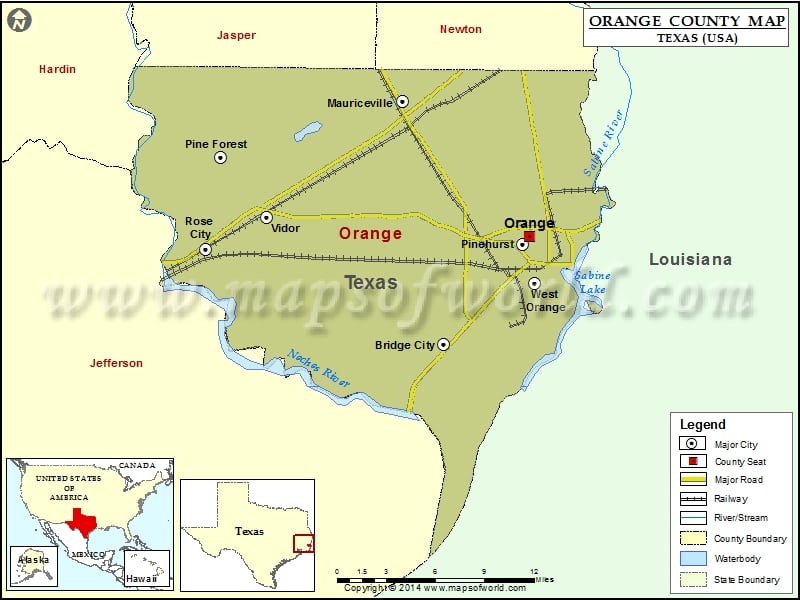
About Orange County
Orange County is a county located in the southeastern part of the state of Texas, and its county seat is the city of Orange. The area is known for its strong economy, with a focus on petrochemicals, manufacturing, and shipping. The county is also home to several higher education institutions, including Lamar State College-Orange. The Orange County map shows major highways and transportation networks that connect the area to other parts of Texas and the United States. The region offers a high quality of life with excellent schools, parks, and cultural amenities, and is a popular destination for fishing, boating, and other outdoor activities along the Sabine River and the Gulf Coast.
Airports in Orange County
| Airport Name |
|---|
| Chesson Airport |
| Jenkins Airport |
| Orange County Airport |
More Maps of Orange County
- Orange County Map, Vermont
- Orange County Map, Florida
- Orange County Map, New York
- Orange County Map, North Carolina
- Orange County Map, Texas
Cities in Orange County
| City | Population | Latitude | Longitude |
|---|---|---|---|
| Bridge City city | 7840 | 30.031614 | -93.839754 |
| Mauriceville | 3252 | 30.218637 | -93.875802 |
| Orange city | 18595 | 30.114558 | -93.76367 |
| Pine Forest city | 487 | 30.175644 | -94.036708 |
| Pinehurst city | 2097 | 30.108673 | -93.770385 |
| Rose City city | 502 | 30.104894 | -94.050474 |
| Vidor city | 10579 | 30.128446 | -93.995964 |
| West Orange city | 3443 | 30.079165 | -93.759871 |
Golf Courses in Orange County
| Name of Golf Course | Latitude | Longitude |
|---|---|---|
| Dupont Employees Rec Assoc.-Orange | 30.062232 | -93.754798 |
| Sunset Grove Country Club-Orange | 30.111888 | -93.761277 |
National Parks in Orange County
| Name of Park | Latitude | Longitude |
|---|---|---|
| Big Thicket N PRES | 30.344357 | -94.267845 |
 Wall Maps