About Houston County
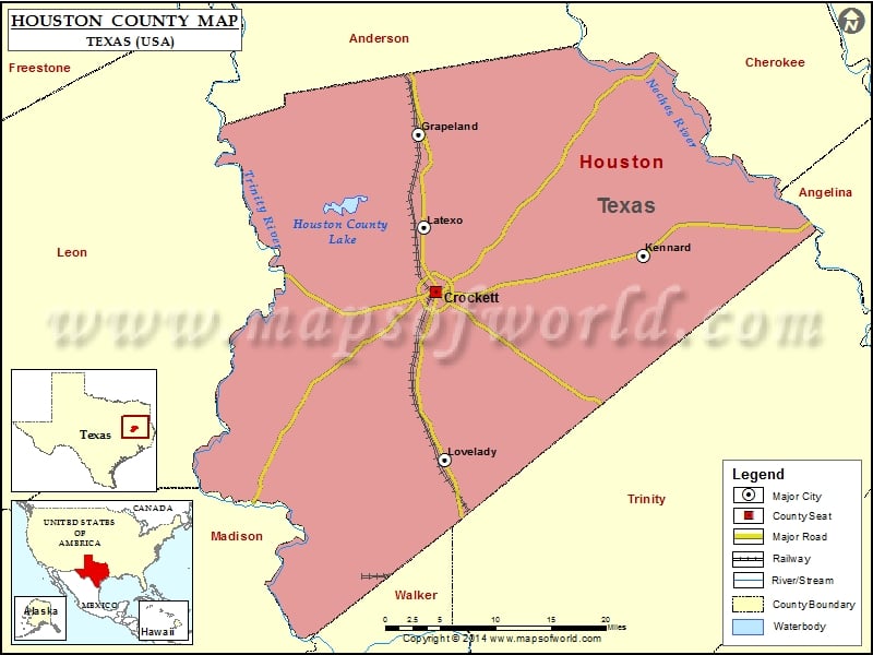
Houston County is a county located in the eastern part of the state of Texas, and its county seat is Crockett. The area is known for its rich history, with landmarks such as the Houston County Courthouse and the Monroe-Crook House. The county is also home to several parks and natural areas, including the Davy Crockett National Forest and the Ratcliff Lake Recreation Area.
The Houston County map shows major highways and transportation networks that connect the area to other parts of Texas and the United States. The region offers a high quality of life with excellent schools, parks, and cultural amenities, and is a popular destination for hunting, fishing, and other outdoor activities along the Neches River and the Davy Crockett National Forest.
Mountain Peaks in Houston County
| Mountain Peak/Hill | Elevation [Meter] |
|---|---|
| Brown Lee Hill (historical) | 75 |
| Dutch Hill | 74 |
| Gary Hill | 77 |
| Kent Hill | 67 |
| Liberty Hill | 109 |
| Sugar Mounds | 73 |
More Maps of Houston County
Airports in Houston County
| Airport Name |
|---|
| Bruner Airport |
| Dibrell Airport |
| East Texas Medical Center Crockett Heliport |
| Flying S Ranch Airport |
| Houston County Airport |
| Houston County Hospital/King’s Inn Heliport |
| Kenley’s Mustang Prairie Ranch Airport |
| Last Resort Airport |
| M Y Ranch Airport |
| W C Ranch Airport |
Cities in Houston County
| City | Population | Latitude | Longitude |
|---|---|---|---|
| Crockett city | 6950 | 31.31768 | -95.456391 |
| Grapeland city | 1489 | 31.494309 | -95.480194 |
| Kennard city | 337 | 31.357503 | -95.18537 |
| Latexo city | 322 | 31.389124 | -95.472428 |
| Lovelady city | 649 | 31.127867 | -95.445619 |
Golf Courses in Houston County
| Name of Golf Course | Latitude | Longitude |
|---|---|---|
| Spring Creek Country Club-Crockett | 31.320865 | -95.458804 |
 Wall Maps