logo


Australia Continent Physical Map

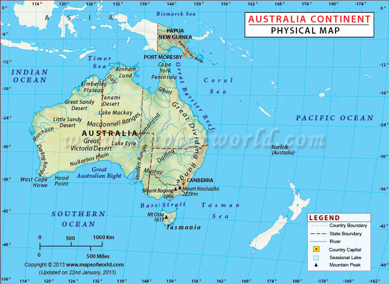
Australia Continent physical map highlights the total area 269,600 square miles with mountain ranges, rivers, plains etc. It comprises the mainland of Australia and proximate islands including Tasmania, New Guinea, the Aru Islands and Raja Ampat Islands.
Australia Continent Physical Map Asia map New zealand map
Description : Physical Map of Australia Continent showing mountain peak, rivers, lakes, country and state boundaries etc. Disclaimer
×

Disclaimer  :  All efforts have been made to make this image accurate. However MapSherpa, Inc, its directors and employees do not own any responsibility for the correctness or authenticity of the same.