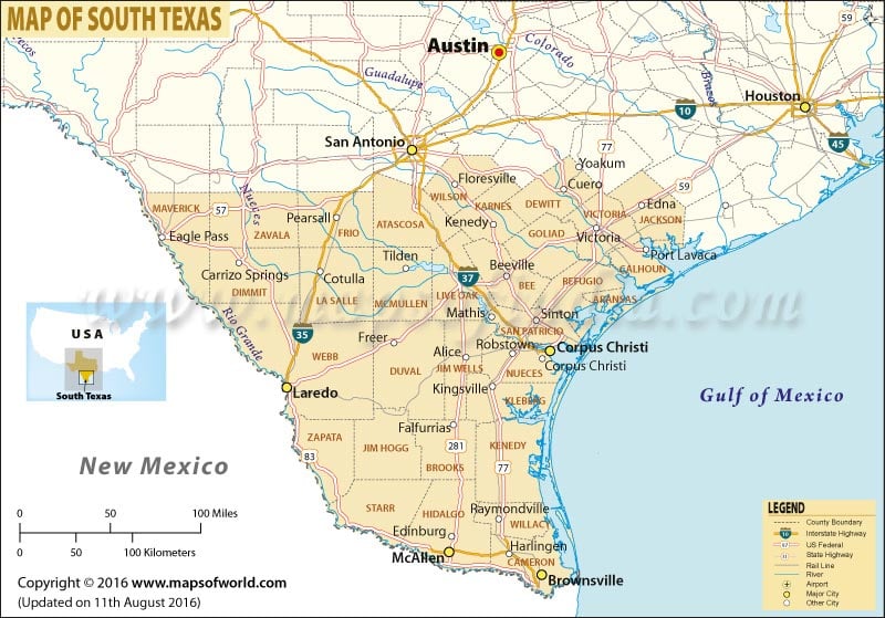
South Texas
From the Texas Coastal Bend in the east to the Hill Country in the west, South Texas is a region of the ‘Lone Star State’. The region lies roughly south of (and including) the city of San Antonio. The Rio Grande defines its southern and western boundary, and to the east it is shielded by the Gulf of Mexico.
South Texas is famous for strong Hispanic cultural influences. With a population of nearly 1.5 million, San Antonio is the largest and the fastest growing city in the region. A renowned destination for wind sports, Corpus Christi is the second largest city in South Texas. Home of the San Agustin Cathedral, Laredo is the third largest city in South Texas. Brownsville – region’s fourth largest city – is also the southernmost city in the contiguous United States.
Stretching up to 113 miles, Padre Island is the longest barrier island in the world. While the South Padre Island drives tourism during the Spring Break season, the North Padre Island is known for upscale condos and as a fishing destination.
Tourism in South Texas
From enthralling recreational opportunities to endless cultural interactions, there’s something for everyone in South Texas. The region’s Plains is an ideal gateway for people looking to avoid winter up north. Some of the most popular destinations in South Texas are:
- San Antonio Missions National Historical Park
- The Alamo
- SeaWorld San Antonio
- Six Flags Fiesta Texas
- San Antonio River Walk
- San Antonio Zoo
- San Antonio Museum of Art
- San Antonio Stock Show and Rodeo
Cities in South Texas
- McAllen
- Mission
- Edinburg
- Pharr
- Harlingen
- Victoria
- Weslaco
- Schertz
- San Juan
Related Maps
 Wall Maps