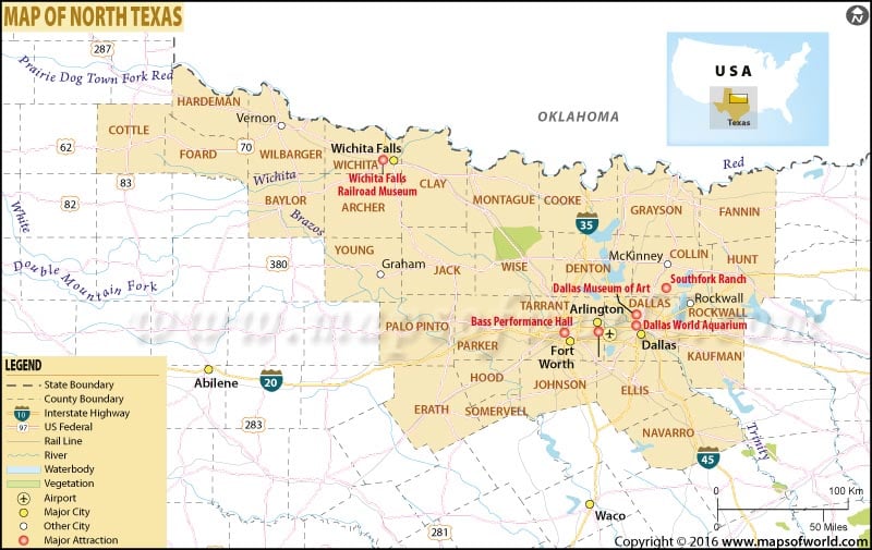
About North Texas Map
The region that lies south of Oklahoma, east of Abilene, and north of Waco in the ‘Lone Star State’ is commonly called North Texas. The region is centered around the Dallas–Fort Worth Metroplex – the largest inland metropolitan area in the United States. It is also referred to as North Central Texas and Nortex. The Western roots and the Civil War heritage make North Texas a destination worth visiting.
Dallas is a cow-town ablaze with neon lights. The city is home to the largest arts district in the United States. The Reunion Tower, Dallas World Aquarium, Sixth Floor Museum at Dealey Plaza, and White Rock Lake are popular attractions in the city. Fort Worth houses a number of art and science museums and large arenas for football games. Both Dallas and Fort Worth – bonded by 30 miles of suburbs – are hotspots of Tex-Mex culture, spectator sports, and high-end shopping in North Texas.
Home to Six Flags Over Texas, Arlington is the largest city in Texas that is not a county seat. The Stockyards National Historic District, Wichita Falls Railroad Museum, and Celebration Station are other travel destinations in the region.
Largest cities in North Texas:
| Plano | Garland | Irving | Grand Prairie | McKinney | Frisco | Mesquite |
For those looking to explore North Texas beyond the Metroplex should take in the scenic views at Arbor Hills Nature Preserve, bike along the Katy Trail, check out fossilized footprints at Dinosaur Valley State Park, and enjoy camping in Cedar Hill State Park.
Related Maps
 Wall Maps