881
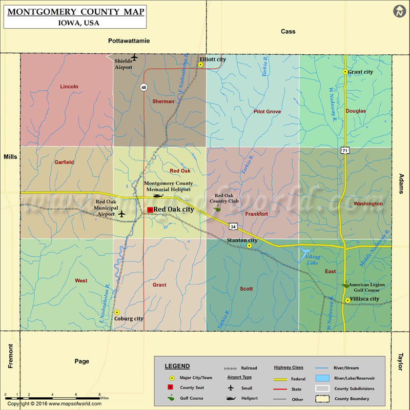
Airports in Montgomery County
| Airport Name |
|---|
| Montgomery County Memorial Heliport |
| Red Oak Municipal Airport |
| Shields Airport |
More Maps of Montgomery County
Cities in Montgomery County
| City | Population | Latitude | Longitude |
|---|---|---|---|
| Coburg city | 42 | 40.918789 | -95.265552 |
| Elliott city | 350 | 41.149367 | -95.162865 |
| Grant city | 92 | 41.142714 | -94.985012 |
| Red Oak city | 5742 | 41.014148 | -95.224825 |
| Stanton city | 689 | 40.981015 | -95.102951 |
| Villisca city | 1252 | 40.929827 | -94.981923 |
Golf Courses in Montgomery County
| Name of Golf Course | Latitude | Longitude |
|---|---|---|
| American Legion Golf Course-Villisca | 40.944928 | -94.984636 |
| Red Oak Country Club-Red Oak | 41.015987 | -95.142689 |
 Wall Maps