1.3K
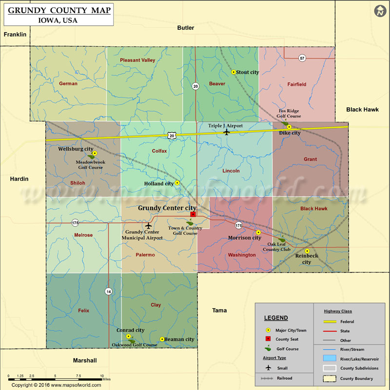
Airports in Grundy County
| Airport Name |
|---|
| Grundy Center Municipal Airport |
| Triple J Airport |
More Maps of Grundy County
Cities in Grundy County
| City | Population | Latitude | Longitude |
|---|---|---|---|
| Beaman city | 191 | 42.220217 | -92.822187 |
| Conrad city | 1108 | 42.223506 | -92.874491 |
| Dike city | 1209 | 42.464134 | -92.625607 |
| Grundy Center city | 2706 | 42.363756 | -92.774401 |
| Holland city | 282 | 42.399955 | -92.798815 |
| Morrison city | 94 | 42.343033 | -92.67314 |
| Reinbeck city | 1664 | 42.321651 | -92.597632 |
| Stout city | 224 | 42.526898 | -92.711545 |
| Wellsburg city | 707 | 42.433847 | -92.926569 |
Golf Courses in Grundy County
| Name of Golf Course | Latitude | Longitude |
|---|---|---|
| Fox Ridge Golf Course-Dike | 42.469598 | -92.632239 |
| Meadowbrook Golf Course-Wellsburg | 42.431281 | -92.932158 |
| Oak Leaf Country Club-Reinbeck | 42.33577 | -92.636882 |
| Oakwood Golf Course-Conrad | 42.21936 | -92.869539 |
| Town & Country Golf Course-Grundy Center | 42.354996 | -92.77949 |
 Wall Maps