1.4K
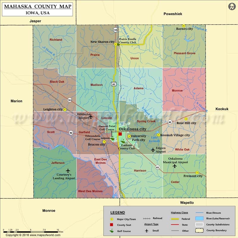
Airports in Mahaska County
| Airport Name |
|---|
| Courtney’s Landing Airport |
| Edgren Airport |
| Oskaloosa Municipal Airport |
| Witthuhn Airport |
Cities in Mahaska County
| City | Population | Latitude | Longitude |
|---|---|---|---|
| Barnes City city | 176 | 41.507059 | -92.469619 |
| Beacon city | 494 | 41.274623 | -92.681397 |
| Fremont city | 743 | 41.212527 | -92.43424 |
| Keomah Village city | 84 | 41.288547 | -92.536766 |
| Leighton city | 162 | 41.338799 | -92.786417 |
| New Sharon city | 1293 | 41.470104 | -92.650924 |
| Oskaloosa city | 11463 | 41.290272 | -92.63899 |
| Rose Hill city | 168 | 41.320361 | -92.463699 |
| University Park city | 487 | 41.285649 | -92.614987 |
Golf Courses in Mahaska County
| Name of Golf Course | Latitude | Longitude |
|---|---|---|
| Edmundson Golf Course-Oskaloosa | 41.28208 | -92.659979 |
| Elmhurst Country Club-Oskaloosa | 41.275845 | -92.631738 |
| Harvest Point Golf Course-Oskaloosa | 41.281958 | -92.660358 |
| Prairie Knolls Country Club-New Sharon | 41.471558 | -92.645627 |
 Wall Maps