1.3K
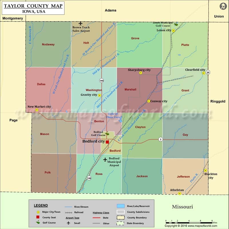
Airports in Taylor County
| Airport Name |
|---|
| Bedford Municipal Airport |
| Brown Truck Sales Airport |
More Maps of Taylor County
- Taylor County Map, Wisconsin
- Taylor County Map, Florida
- Taylor County Map, Texas
- Taylor County Map, Georgia
Cities in Taylor County
| City | Population | Latitude | Longitude |
|---|---|---|---|
| Athelstan | 19 | 40.572702 | -94.542631 |
| Bedford city | 1440 | 40.67115 | -94.724037 |
| Blockton city | 192 | 40.616818 | -94.477928 |
| Clearfield city | 363 | 40.802544 | -94.482555 |
| Conway city | 41 | 40.749248 | -94.620053 |
| Gravity city | 188 | 40.760165 | -94.743501 |
| Lenox city | 1407 | 40.883042 | -94.558336 |
| New Market city | 415 | 40.732363 | -94.900495 |
| Sharpsburg city | 89 | 40.802969 | -94.640482 |
Golf Courses in Taylor County
| Name of Golf Course | Latitude | Longitude |
|---|---|---|
| Bedford Golf Course-Bedford | 40.688027 | -94.724543 |
| Lenox Municipal Golf Course-Lenox | 40.89626 | -94.552369 |
 Wall Maps