1.9K
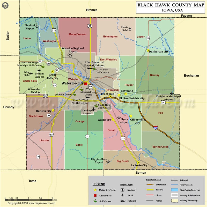
Airports in Black Hawk County
| Airport Name |
|---|
| Allen Memorial Hospital Heliport |
| Bluebird Airport |
| Cmc At West Ninth Heliport |
| Creighton Municipal Airport |
| Davis Field |
| Flyers Airport |
| Hawkeye Airport |
| Higgins Bros Airport |
| Iowa Army Natl Guard Heliport |
| Isley Field |
| Lemons Airport |
| Waterloo Regional Airport |
| Witcombe Field |
Cities in Black Hawk County
| City | Population | Latitude | Longitude |
|---|---|---|---|
| Cedar Falls city | 39260 | 42.519694 | -92.45326 |
| Dunkerton city | 852 | 42.567711 | -92.160784 |
| Elk Run Heights city | 1117 | 42.466135 | -92.250073 |
| Evansdale city | 4751 | 42.46347 | -92.276468 |
| Gilbertville city | 712 | 42.418995 | -92.2142 |
| Hudson city | 2282 | 42.432001 | -92.451909 |
| La Porte City city | 2285 | 42.313721 | -92.191199 |
| Raymond city | 788 | 42.469381 | -92.229579 |
| Washburn | 876 | 42.411125 | -92.268493 |
| Waterloo city | 68406 | 42.491974 | -92.352176 |
Golf Courses in Black Hawk County
| Name of Golf Course | Latitude | Longitude |
|---|---|---|
| All Golf Center-Waterloo | 42.469395 | -92.387095 |
| Beaver Hills Country Club-Cedar Falls | 42.570323 | -92.515407 |
| Gates Park Golf Course-Waterloo | 42.527448 | -92.327061 |
| Irv Warren Memorial Golf Course-Waterloo | 42.48033 | -92.366026 |
| Jesup Country Club-Jesup | 42.450018 | -92.169149 |
| La Porte City Golf Course-La Porte City | 42.312038 | -92.168217 |
| Pheasant Ridge Municipal Golf Course-Cedar Falls | 42.532338 | -92.483893 |
| Red Carpet Golf Club-Waterloo | 42.513037 | -92.314285 |
| South Hills Golf Course-Waterloo | 42.442858 | -92.320264 |
| Sunnyside Country Club-Waterloo | 42.460832 | -92.382252 |
| Washington Park Golf Course-Cedar Falls | 42.52792 | -92.437015 |
 Wall Maps