976
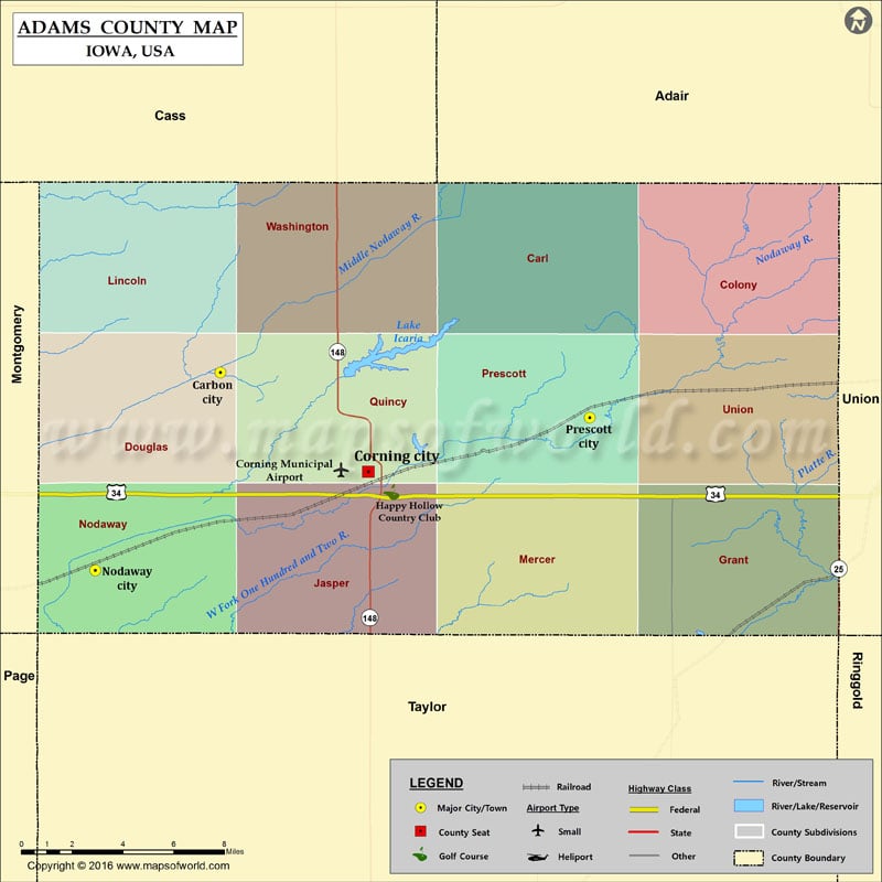
Airports in Adams County
| Airport Name |
|---|
| Corning Municipal Airport |
More Maps of Adam County
Cities in Adams County
| City | Population | Latitude | Longitude |
|---|---|---|---|
| Carbon City | 34 | 41.049661 | -94.824003 |
| Corning city | 1635 | 40.992908 | -94.739487 |
| Nodaway city | 114 | 40.936549 | -94.895383 |
| Prescott city | 257 | 41.023804 | -94.61298 |
Golf Courses in Adams County
| Name of Golf Course | Latitude | Longitude |
|---|---|---|
| Happy Hollow Country Club-Corning | 40.981289 | -94.726225 |
 Wall Maps