1.4K
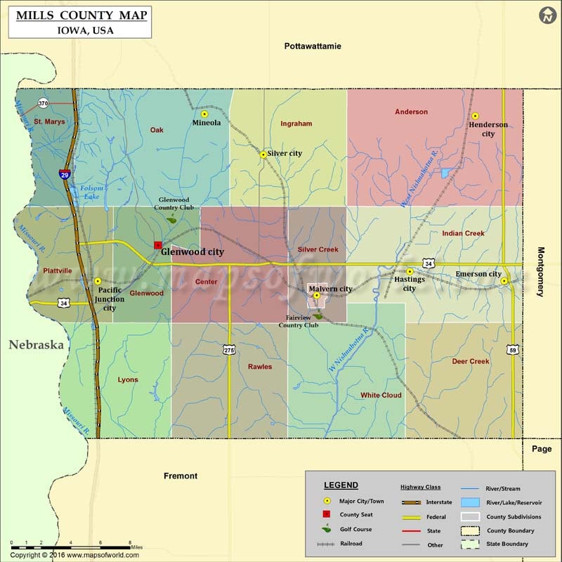
Cities in Mills County
| City | Population | Latitude | Longitude |
|---|---|---|---|
| Emerson city | 438 | 41.018044 | -95.402742 |
| Glenwood city | 5269 | 41.044521 | -95.740775 |
| Hastings city | 152 | 41.025088 | -95.494828 |
| Henderson city | 185 | 41.139987 | -95.430974 |
| Malvern city | 1142 | 41.007562 | -95.585666 |
| Mineola | 166 | 41.141457 | -95.695318 |
| Pacific Junction city | 471 | 41.017989 | -95.799562 |
| Silver City city | 245 | 41.111388 | -95.637873 |
More Maps of Mills County
Golf Courses in Mills County
| Name of Golf Course | Latitude | Longitude |
|---|---|---|
| Fairview Country Club-Malvern | 40.993227 | -95.584894 |
| Glenwood Country Club-Glenwood | 41.064357 | -95.727564 |
 Wall Maps