1.1K
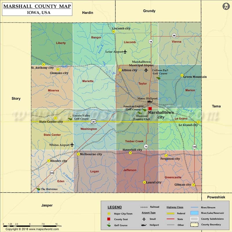
Airports in Marshall County
| Airport Name |
|---|
| Leise Airport |
| Marshalltown Municipal Airport |
| Mmsc Heliport |
| Whites Airport |
More maps of Marshall County
Cities in Marshall County
| City | Population | Latitude | Longitude |
|---|---|---|---|
| Albion city | 505 | 42.112526 | -92.988741 |
| Clemons city | 148 | 42.113898 | -93.158508 |
| Ferguson city | 126 | 41.93858 | -92.863031 |
| Gilman city | 509 | 41.878809 | -92.78814 |
| Green Mountain | 126 | 42.101917 | -92.819626 |
| Haverhill city | 173 | 41.944121 | -92.96074 |
| Laurel city | 239 | 41.884062 | -92.922164 |
| Le Grand city | 938 | 42.006693 | -92.774982 |
| Liscomb city | 301 | 42.191029 | -93.006172 |
| Marshalltown city | 27552 | 42.034102 | -92.906695 |
| Melbourne city | 830 | 41.941548 | -93.102616 |
| Rhodes city | 305 | 41.927826 | -93.183691 |
| St. Anthony city | 102 | 42.123908 | -93.197776 |
| State Center city | 1468 | 42.014901 | -93.165259 |
Golf Courses in Marshall County
| Name of Golf Course | Latitude | Longitude |
|---|---|---|
| American Legion Golf Course-Marshalltown | 42.03302 | -92.922461 |
| Collison Par3 Golf Course-Marshalltown | 42.097774 | -92.884272 |
| Elmwood Country Club-Marshalltown | 42.026587 | -92.934986 |
| Lincoln Valley Golf Course-State Center | 42.014649 | -93.125262 |
| The Harvester-Rhodes | 41.8717 | -93.212389 |
 Wall Maps