1.3K
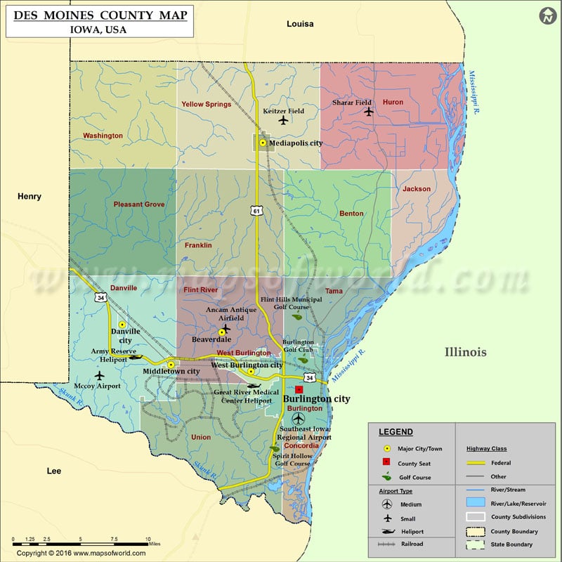
Airports in Des Moines County
| Airport Name |
|---|
| Ancam Antique Airfield |
| Army Reserve Heliport |
| Great River Medical Center Heliport |
| Keitzer Field |
| Mccoy Airport |
| Sharar Field |
| Southeast Iowa Regional Airport |
Cities in Des Moines County
| City | Population | Latitude | Longitude |
|---|---|---|---|
| Beaverdale | 952 | 40.853736 | -91.20768 |
| Burlington city | 25663 | 40.807187 | -91.124895 |
| Danville city | 934 | 40.860037 | -91.314558 |
| Mediapolis city | 1560 | 41.007889 | -91.163745 |
| Middletown city | 318 | 40.82734 | -91.262221 |
| West Burlington city | 2968 | 40.821838 | -91.176369 |
Golf Courses in Des Moines County
| Name of Golf Course | Latitude | Longitude |
|---|---|---|
| Burlington Golf Club-Burlington | 40.832613 | -91.120643 |
| Flint Hills Municipal Golf Course-Burlington | 40.86786 | -91.127092 |
| Spirit Hollow Golf Course-Burlington | 40.76052 | -91.151139 |
 Wall Maps