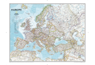
Scandinavian Countries
Located in Northern Europe, Scandinavia comprises the three kingdoms of
Norway,
Sweden and
Denmark. There have also been arguments for the inclusion of Finland into Scandinavia on economic and geological grounds. Iceland and the Faroe Islands have been favored as the people of these two countries speak Scandinavian languages.
The Scandinavian countries are considered to be the best governed in the world. People here have a long life span and literacy levels are extremely high. The Scandinavian countries are sparsely populated and have a combined population of a little over 20,000,000. Of the three Scandinavian countries,
Sweden is the largest with an area spanning over 450,295 sq. km, while Denmark is the smallest stretching over only 43,094 sq. km. The Scandinavian countries are extremely prosperous.
In 2013, the region was way ahead of the rest of Europe with the economic growth of Norway and
Sweden pegged at 0.7 percent and 1.3 percent respectively. The "Country RepTrak", released by Reputation Institute, a global private consulting firm based in Boston and Copenhagen in 2015, has rated Norway as the second and
Sweden the third most reputable countries, while Denmark stands at the eighth position.
Last Updated on: February 25th, 2020