- Illinois Counties - Illinoise County Map, Map of Illinois Counties
- Major Cities of Illinois - Rockford, Springfield, Peoria, Champaign, Chicago
- Neighbouring States - Wisconsin, Iowa, Michigan, Indiana, Missouri, Kentucky
- Regional Maps - Map of USA
- Other Illinois Maps - Illinois Map, Where is Illinois, Illinois Airports Map, Illinois Lat Long Map, Illinois Zip Code Map, Illinois Area Code Map
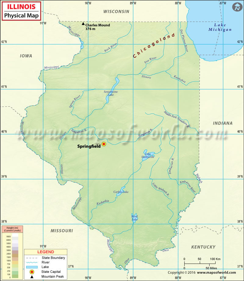
Illinois Physical Map
The state of Illinois has three major physical regions: Northern, Central, and Southern. Northern Illinois is known as Upstate Illinois or Chicagoland and Central and Southern Illinois are collectively referred as Downstate Illinois.
From the Chicago suburbs along the Lake Michigan, the land gradually rises to the west into a hilly area in the northwestern Illinois. Charles Mound, at 376 meters (1,235 feet) above sea level, is the highest point in the state. This far northwestern portion of the state features the rugged and unglaciated Driftless Zone. The region is also a part of the Coulee Region which is made of bluffs, valleys, and rolling hills.
The southern two-thirds of the state are an extension of America’s Corn Belt. Here the farmlands stretch into the states of Iowa, Indiana, and Missouri. Central Illinois is an area of mostly flat prairies except the hills and bluffs along the Illinois and Mississippi river. These uplands rising high above the rivers provide commanding views of flat terrain.
The Shawnee Hills region in Southern Illinois stretches for about 40 miles in width and 70 miles in length. The hills are nearly 1,000 feet in elevation. The Shawnee National Forest comprises more than 270,000 acres of land in the region. The American Bottom, the flood plain of the Mississippi River, lies in Southern Illinois.
The state’s entire western border is formed by the Mississippi River, while southeastern & southern boundaries are defined by the Wabash River and the Ohio River respectively. In addition to Lake Michigan, major lakes in Illinois include Carlyle, Rend, Shelbyville and Upper Peoria.
 Wall Maps