886
Mountain Peaks in Hancock County
| Mountain Peak/Hill | Elevation [Meter] |
|---|---|
| Mount Moriah | 194 |
More Maps of Hancock County
Airports in Hancock County
| Airport Name |
|---|
| Cedar Ridge Airport |
| Douglas Airport |
| Hester Airport |
| Jan Knipe Airport |
| Lung RLA Restricted Landing Area |
| Mc Pherson Airport |
| Memorial Hospital Heliport |
| Morton Airport |
| Rhea Restricted Landing Area |
| Schilson Field |
| Sinele Strip |
| Sinele’s Sunset Strip |
| Sullivan Airport |
| Williams Airport |
| Winchester Airport |
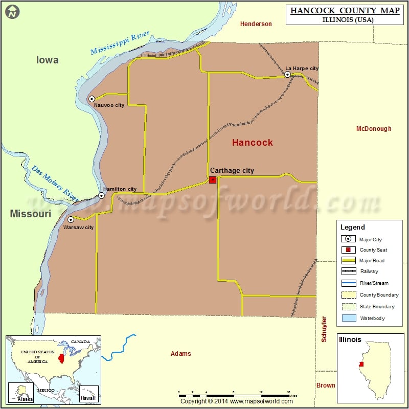
Cities in Hancock County
| City | Population | Latitude | Longitude |
|---|---|---|---|
| Augusta village | 587 | 40.230927 | -90.949788 |
| Basco village | 98 | 40.327801 | -91.199495 |
| Bentley town | 35 | 40.343848 | -91.111675 |
| Bowen village | 494 | 40.232054 | -91.063282 |
| Carthage city | 2605 | 40.41444 | -91.127771 |
| Dallas City city | 945 | 40.635268 | -91.164442 |
| Elvaston village | 165 | 40.395426 | -91.249312 |
| Ferris village | 156 | 40.469546 | -91.168338 |
| Hamilton city | 2951 | 40.389944 | -91.362305 |
| La Harpe city | 1235 | 40.584796 | -90.969567 |
| Nauvoo city | 1149 | 40.545623 | -91.382843 |
| Plymouth village | 505 | 40.292121 | -90.916303 |
| Pontoosuc village | 146 | 40.628394 | -91.21118 |
| Warsaw city | 1607 | 40.350934 | -91.427746 |
| West Point village | 178 | 40.255576 | -91.183307 |
Golf Courses in Hancock County
| Name of Golf Course | Latitude | Longitude |
|---|---|---|
| Carthage Golf Course-Carthage | 40.41594 | -91.092034 |
| Deer Run Golf Course-Hamilton | 40.40403 | -91.342675 |
| Great River Road Golf Club-Nauvoo | 40.541609 | -91.364017 |
| Lamoine Valley Golf Club-La Harpe | 40.583488 | -90.972557 |
| Tri County Country Club-Augusta | 40.238885 | -90.94969 |
 Wall Maps