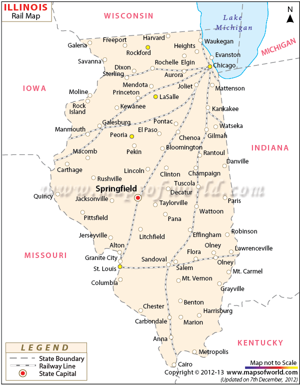
Illinois Rail Network
Illinois Rail Map indicates the wide network of railways which connect the major towns and cities of the state.
The Illinois state map is also an useful guide which provides information about the rail routes of the state. During 1850s the state of railways in Illinois gained a new momentum. According to the past records in the year of 1890 a total of 16, 000 km of tracks were laid down in the state of Illinois. With the increasing demand of rail transport several railroad agencies also started to emerge in Illinois state. Although the railroad industry passed through an adverse phase in 1920s and 1930s, a total of 17, 070 km of rail tracks were constructed in 1974. Today, as per a survey of 2000, Illinois state consists of 16, 349 km of racks and 41 railroad organizations. Amtrak is one of the major railway service providers of Illinois.
In the year 1996 Amtrak provided 20 trains to different railway routes of Illinois. From local people to tourists Illinois offers regular train services to one and all. The railway map of Illinois performs the function of a helpful guide which locates the track routes of various trains passing through cities, counties and towns of the state.
 Wall Maps