Magnitude 6.9 earthquake struck southwest of the Philippine city of Tacloban |
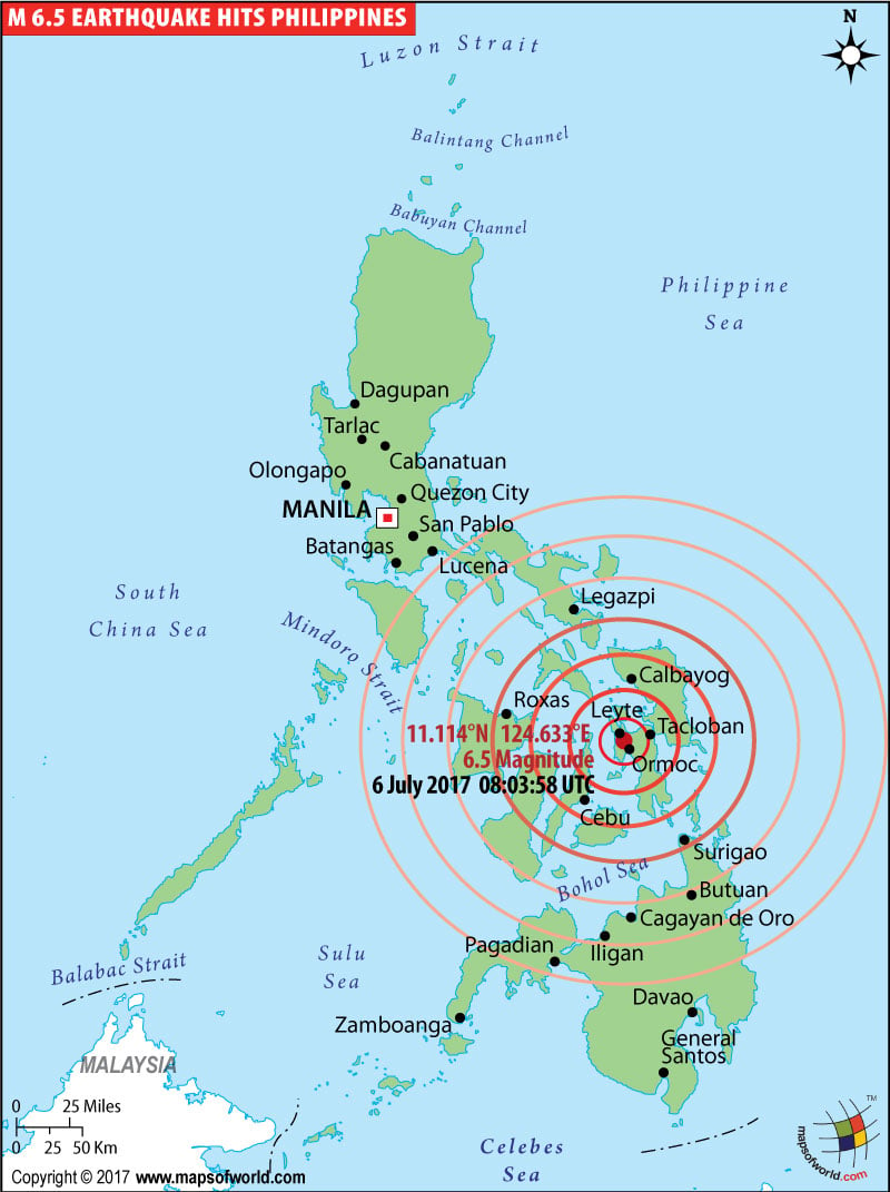 |
Map showing location of a magnitude 6.9 earthquake struck southwest of the Philippine city of Tacloban. |
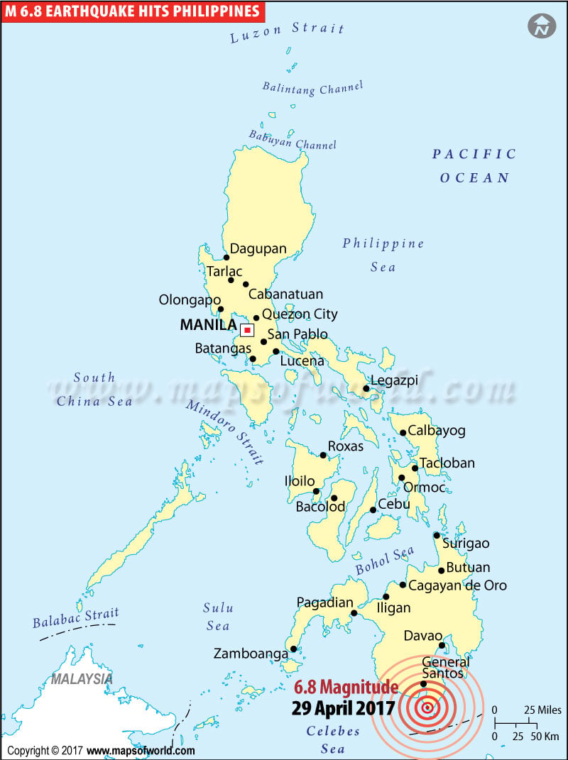
M6.8 Earthquake Hits Mindanao, Philippines |
 |
Philippines Earthquake Map |
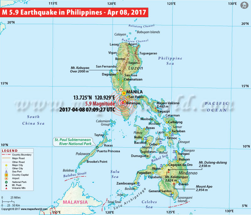
5.9M Earthquake Strikes Philippines |
 |
Philippines Earthquake Map |
Philippines Earthquake Map |
 |
Philippines Earthquake Map |
M6.1 Earthquake hits Philippines - July 3, 2015 |
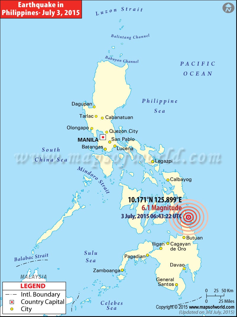 |
Map showing the epicentre of M6.1 earthquake hits 22km NW of Santa Monica, Philippines on July 3, 2015 |
History of Earthquakes in Philippines |
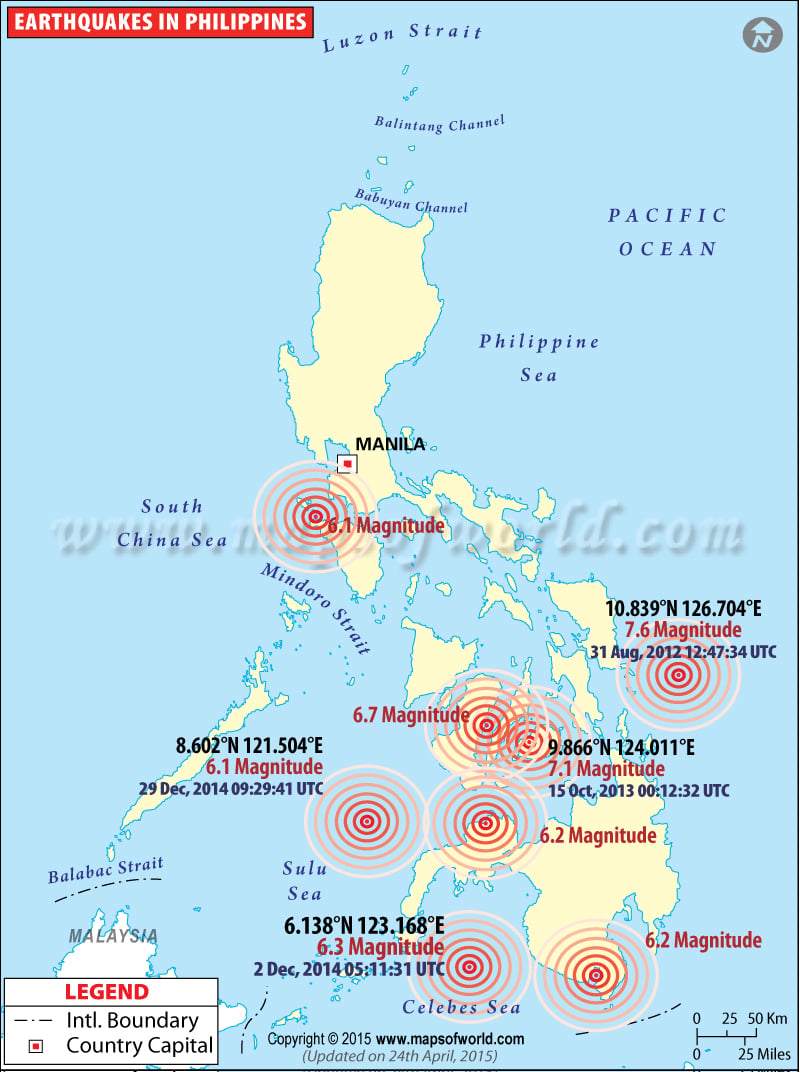 |
Map showing location of various historic earthquakes which occurred in Philippines |
Philippines Earthquake Map
Map showing recent earthquake in Philippines
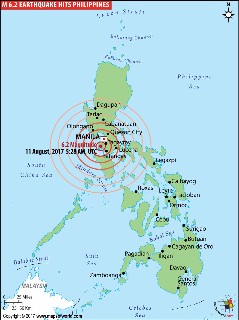
| Description :Map showing location of a magnitude 6.2 earthquake struck 2km WSW of Tuy, Philippines on 11 August 2017. |
| Disclaimer |
*We specifically create maps that have a magnitude of 6 or more on the Richter Scale.
2017-07-06 5:39 AM ET: An earthquake of magnitude 6.9 struck southwest of the Philippine city of Leyte and Tacloban on Thursday, which hit at a depth of 41 km (26 miles) about 580 km (360 miles) southwest of the capital, Manila.
Explore Map: Philippines Map, Philippines Cities Map, Where is Philippines? , Leyte Map, Where is Tacloban
M6.8 Earthquake Hits Mindanao, Philippines
2017-04-28 20:23:17 UTC: As per reports, a strong earthquake measuring 6.8 magnitudes hit the coast of Mindanao island in the Philippines on Saturday. The tremors were felt in many parts of Mindanao.
As mentioned by the Pacific Tsunami Warning Center, dangerous waves could spread 300 km away from the epicentre. However, some other sources mentioned that tsunami warning was not issued and there was no need of any evacuation from the areas affected.
There were no reports of any casualties or damage.
5.9M Earthquake Hits Philippines near Manila
Reports from US Geological Survey (USGS) mentioned that a magnitude of 5.9 earthquake has hit the Philippines.
Two other quakes of magnitude 5.0 to 5.9 struck Batangas in the Luzon province, which is about 55 miles (90km) south of Manilla. All the quakes occurred within 20 minutes.
There were no report of damages.
Two other quakes of magnitude 5.0 to 5.9 struck Batangas in the Luzon province, which is about 55 miles (90km) south of Manilla. All the quakes occurred within 20 minutes.
There were no report of damages.
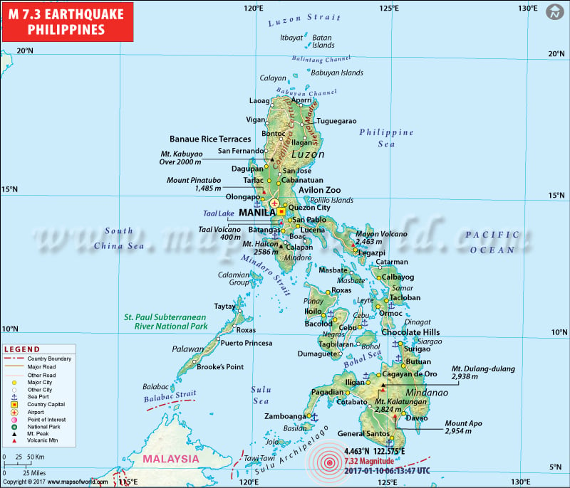
7.3 M Earthquake Strikes Philippines
2017-01-10 06:13:47 UTC: As per reports, a huge undersea earthquake of 7.3 magnitude has hit the southeast of the island of Jolo on Tuesday. The tremor has been measured at a depth of 617 km (380 miles). No threat of tsumani has been issued.
M6.1 Earthquake - 22km NW of Santa Monica, Philippines - July 3, 2015
Time 06:43:22 (UTC)
Nearby Cities
22km (14mi) NW of Santa Monica, Philippines
62km (39mi) NE of Surigao, Philippines
65km (40mi) NNE of Placer, Philippines
97km (60mi) S of Guiuan, Philippines
725km (450mi) SE of Manila, Philippines
Co-ordinates : 10.171°N 125.899°E depth : 33.0 km (20.5 mi)
6.1 Magnitude Earthquake hit Zamboanga City in Mindanao, Philippines
A magnitude 6.1 earthquake hit Zamboanga City in Mindanao, Philippines, as per media reports. Philippine Institute of Volcanology and Seismology (Phivolcs) said the tremor occurred at 5.29 p.m. its epicenter was traced 205 kilometers northwest of Zamboanga City. No casuality or damage has been reported from the earthquake. However, Phivolcs has warned of accompanying aftershocks.
6.2 Magnitude Earthquake Near Alim, Philippines
Restless tectonic activity along the Philippine Sea Plate has caused an earthquake in the Philippines, 38 km west and south west of the city, Alim. The magnitude recorded was 6.2 on the Richter Scale, as per USGS reports. The quake occurred today, May 15th, in the ocean close to Sulu Sea, causing tremors in nearby cities of Alim, Asia, and Sipalay.
Reference: USGS
| Earthquakes in Philippines | |||
| Date | Location | Magnitude | Fatalities |
|---|---|---|---|
| Aug 16, 1976 | Mindanao, Philippines | M 7.9 | Fatalities 8,000 |
| Jul 16, 1990 | Luzon, Philippine Islands | M 7.7 | Fatalities 1,621 |
| Jan 1, 2001 | Mindanao, Philippines | M 7.5 | |
| Mar 5, 2002 | Mindanao, Philippines | M 7.5 | Fatalities 15 |
| Nov 18, 2003 | Samar, Philippines | M 6.5 | Fatalities 1 |
| Oct 8, 2004 | Mindoro, Philippines | M 6.5 | |
| Oct 4, 2009 | Moro Gulf, Mindanao, Philippines | M 6.6 | |
| Jul 23, 2010 | Moro Gulf, Mindanao, Philippines | M 7.3 | |
| Jul 23, 2010 | Moro Gulf, Mindanao, Philippines | M 7.6 | |
| Jul 23, 2010 | Moro Gulf, Mindanao, Philippines | M 7.4 | |
