885
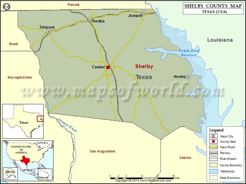
Check this Texas County Map to locate all the state’s counties in Texas Map.
Mountain Peaks in Shelby County
| Mountain Peak/Hill | Elevation [Meter] |
|---|---|
| Bennett Mountain | 159 |
| Big Hill | 164 |
| Bone Hill | 105 |
| Hollow Rock Mountain | 172 |
More Maps of Shelby County
Airports in Shelby County
| Airport Name |
|---|
| Center Municipal Airport |
Cities in Shelby County
| City | Population | Latitude | Longitude |
|---|---|---|---|
| Center city | 5193 | 31.794368 | -94.179303 |
| Huxley city | 385 | 31.765386 | -93.885341 |
| Joaquin city | 824 | 31.965906 | -94.050479 |
| Tenaha town | 1160 | 31.944048 | -94.245748 |
| Timpson city | 1155 | 31.90649 | -94.397131 |
Golf Courses in Shelby County
| Name of Golf Course | Latitude | Longitude |
|---|---|---|
| Center Country Club-Center | 31.80844 | -94.192434 |
 Wall Maps