1K
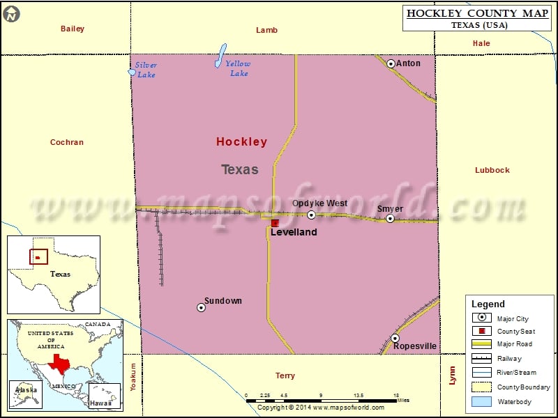
Check this Texas County Map to locate all the state’s counties in Texas Map.
Airports in Hockley County
| Airport Name |
|---|
| Levelland Municipal Airport |
Cities in Hockley County
| City | Population | Latitude | Longitude |
|---|---|---|---|
| Anton city | 1126 | 33.811319 | -102.162173 |
| Levelland city | 13542 | 33.580601 | -102.36351 |
| Opdyke West town | 174 | 33.592705 | -102.300622 |
| Ropesville city | 434 | 33.413336 | -102.155103 |
| Smyer town | 474 | 33.587382 | -102.163501 |
| Sundown city | 1397 | 33.457546 | -102.490809 |
Golf Courses in Hockley County
| Name of Golf Course | Latitude | Longitude |
|---|---|---|
| Levelland Country Club-Levelland | 33.569229 | -102.37066 |
| Sundown Municipal Golf Course-Sundown | 33.456491 | -102.496695 |
 Wall Maps