1.1K
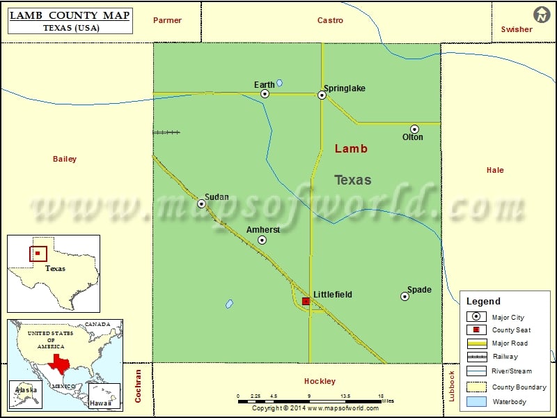
Check this Texas County Map to locate all the state’s counties in Texas Map.
Airports in Lamb County
| Airport Name |
|---|
| Del-Tex Airport |
| Littlefield Municipal Airport |
| Sudan Airport |
Cities in Lamb County
| City | Population | Latitude | Longitude |
|---|---|---|---|
| Amherst city | 721 | 34.011982 | -102.414775 |
| Earth city | 1065 | 34.2338 | -102.409176 |
| Littlefield city | 6372 | 33.919082 | -102.334882 |
| Olton city | 2215 | 34.180199 | -102.137039 |
| Spade | 73 | 33.926033 | -102.154241 |
| Springlake town | 108 | 34.231621 | -102.305734 |
| Sudan city | 958 | 34.066415 | -102.524193 |
Golf Courses in Lamb County
| Name of Golf Course | Latitude | Longitude |
|---|---|---|
| Littlefield Golf Course-Littlefield | 33.91683 | -102.301912 |
| Olton Recreation Center Golf Course-Olton | 34.18912 | -102.136759 |
 Wall Maps