1.3K
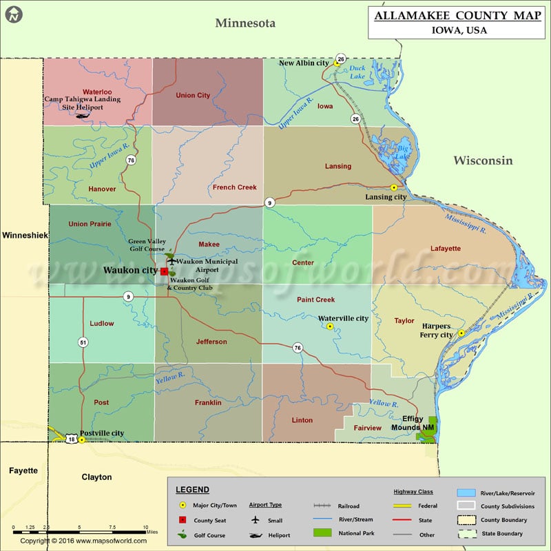
Airports in Allamakee County
| Airport Name |
|---|
| Camp Tahigwa Landing Site Heliport |
| Waukon Municipal Airport |
Cities in Allamakee County
| City | Population | Latitude | Longitude |
|---|---|---|---|
| Harpers Ferry city | 328 | 43.200912 | -91.152009 |
| Lansing city | 999 | 43.36069 | -91.225857 |
| New Albin city | 522 | 43.49698 | -91.288157 |
| Postville city | 2227 | 43.083949 | -91.568213 |
| Waterville city | 144 | 43.208322 | -91.296027 |
| Waukon city | 3897 | 43.268567 | -91.477857 |
Golf Courses in Allamakee County
| Name of Golf Course | Latitude | Longitude |
|---|---|---|
| Green Valley Golf Course-Waukon | 43.288331 | -91.472312 |
| Waukon Golf & Country Club-Waukon | 43.268509 | -91.470583 |
National Parks in Allamakee County
| Name of Park | Latitude | Longitude |
|---|---|---|
| Effigy Mounds NM | 43.086407 | -91.187252 |
 Wall Maps