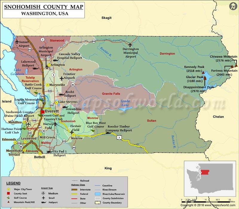
Check this Washington County Map to locate all the state’s counties in Washington Map.
Snohomish County is located in the Puget Sound of Washington state. With over 770,000 inhabitants, it is the third most populous county in the state. Created out of Island County in 1861, the county is named after the Snohomish tribe. The county seat is Everett, which is the seventh-largest city in Washington. Bounded by the summits of the Cascade Range to the east, the county covers an area of 2,196 square miles.
Glacier Peak, at 3,212.90 meters, is the highest point in the county. Interstate 5, SR 9, and SR 99 are primary north-south routes while US 2 is the only major east-west road in the county. Amtrak’s Cascades and the Empire Builder trains serve three stations in Snohomish County. Boeing’s assembly plant in Everett is the world’s largest building by volume. Future of Flight Aviation Center, Mukilteo Lighthouse Park, Snohomish County Centennial Trail, Wallace Falls State Park, Imagine Children’s Museum, and Big Four Ice Caves are popular points of interest in the county.
Facts about Snohomish county in Washington |
|
|---|---|
| County Name | Snohomish county |
| Population | 7,59,583 |
| Founded | 14 January 1861 |
| Area | 2,196 sq mi (5,688 sq km) |
| Land Area | 2,087 sq mi (5,405 sq km) |
| Water Area | 109 sq mi (282 sq km), 5.0% |
| Largest City | Everett |
| Cities | Everett, Monroe, Mukilteo, Granite Falls, Brier, Snohomish, Lake Stevens, Mill Creek, Sultan, Woodway, Lynnwood, Arlington, Stanwood, Darrington, Clearview, Marysville, Edmonds, Mountlake, Gold Bar, Index, Smokey Point, Fobes Hill, Bryant |
| County Seat | Everett |
| Timezone | Pacific: UTC-8/-7 |
 Wall Maps