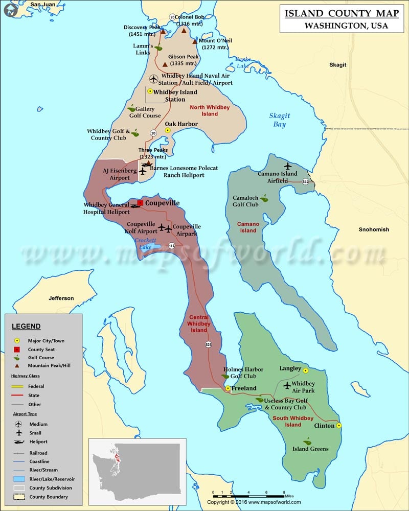
Check this Washington County Map to locate all the state’s counties in Washington Map.
Founded on December 22, 1852, Island County is located in the Puget Sound region of Washington. With an area of 517 square miles, it is the second-smallest county in Washington. The county is made up entirely of islands and 60% area is water. Whidbey and Camano are the two large and most inhabited islands in Island County. Seven smaller islands in the county are: Baby, Ben Ure, Deception, Kalamut, Minor, Smith, and Strawberry.
Its county seat is Coupeville and its largest incorporated city is Oak Harbor. Both of these settlements are situated on Whidbey Island. Coupeville lies within Ebey’s Landing National Historical Reserve, which offers breathtaking marine views. Langley, the island’s third largest settlement, hosts the Island County Fair. State Route 20 & SR 525 serve Whidbey Island and SR 532 passes through Camano Island.
The Island County Parks and Recreation Department maintains 54 parks with ample recreational opportunities for everyone. The 4,100-acre Deception Pass State Park features campsites, trails, and scenic vistas of the San Juan Islands. Deception Pass Bridge is perhaps the most photographed landmark in the region.
Facts about Island county in Washington |
|
|---|---|
| County Name | Island county |
| Population | 79,275 |
| Founded | 6 January 1853 |
| Area | 517 sq mi (1,339 sq km) |
| Land Area | 208 sq mi (539 sq km) |
| Water Area | 309 sq mi (800 sq km), 59.7% |
| Largest City | Oak Harbor |
| Cities | Oak Harbor, Coupeville, Langley, Greenbank, Bayview |
| County Seat | Coupeville |
| Timezone | Pacific: UTC-8/-7 |
 Wall Maps