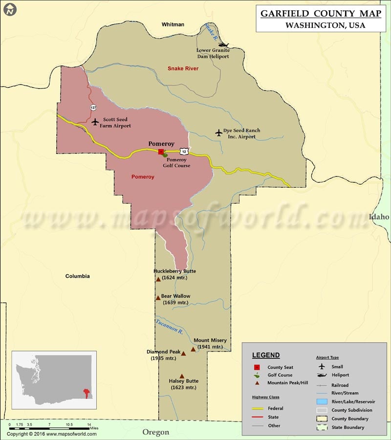
Check this Washington County Map to locate all the state’s counties in Washington Map.
Garfield County is located in southeastern Washington. Established on November 29, 1881, the county covers an area of 718 square miles. Pomeroy is the county seat and the county’s only city. To the north lies the Snake River Valley while the Blue Mountains cover the county’s southern area. Garfield County is the least populous and the least densely populated county in Washington, with about 3.2 inhabitants per square mile.
The Snake River defines nearly all of its northern border. Agriculture, mostly wheat production, is the mainstay of the county’s economy. The campgrounds and hiking trails in Umatilla National Forest entice visitors to spend a rural weekend away from it all. Lower Granite Dam is another popular spot to enjoy fishing, picnicking, and water sports. US Route 12 is the major east-west corridor in the county and it passes through the city of Pomeroy.
More Maps of Garfield County
Facts about Garfield county in Washington |
|
|---|---|
| County Name | Garfield county |
| Population | 2,215 |
| Founded | 29 November 1881 |
| Area | 718 sq mi (1,860 sq km) |
| Land Area | 711 sq mi (1,841 sq km) |
| Water Area | 7.5 sq mi (19 km2), 1.0% |
| Largest City | Pomeroy |
| Cities | Pomeroy |
| County Seat | Pomeroy |
| Timezone | Pacific: UTC-8/-7 |
 Wall Maps