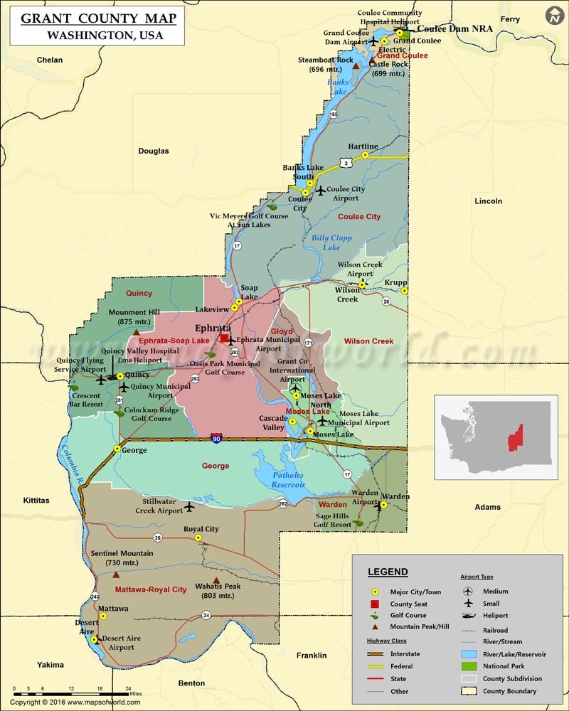
Check this Washington County Map to locate all the state’s counties in Washington Map.
Founded on February 24, 1909, Grant County is located in central Washington. The county seat is Ephrata and its largest city is Moses Lake. The county is named for US President Ulysses S. Grant. It covers an area of 2,791 square miles. The Grand Coulee Dam in the county is the largest electric power-producing dam in the United States.
The Gorge Amphitheatre, Dry Falls, Moses Lake Museum & Art Center (MAC), Grant County Historical Museum, and Summer Falls State Park are popular destinations in the county. Interstate 90, US 2, SR 17, and SR 28 are major corridors in Grant County. Grant County International Airport (MWH) is used as a major jet training and testing facility. Amtrak’s Empire Builder train makes a stop at Ephrata station.
More Maps of Grant County
- Grant County Map, Wisconsin
- Grant County Map, South Dakota
- Grant County Map, North Dakota
- Grant County Map, Nebraska
Facts about Grant county in Washington |
|
|---|---|
| County Name | Grant county |
| Population | 93,147 |
| Founded | 24 February 1909 |
| Area | 2,791 sq mi (7,229 sq km) |
| Land Area | 2,680 sq mi (6,941 km2) |
| Water Area | 112 sq mi (290 sq km), 4.0% |
| Largest City | Moses Lake |
| Cities | Moses Lake , Soap Lake, Coulee City, Wilson Creek, Hartline, Ephrata, Grand Coulee, Royal City, Electric City, Krupp, Quincy , Mattawa, Warden , George |
| County Seat | Ephrata |
| Timezone | Pacific: UTC-8/-7 |
 Wall Maps