Check this Washington County Map to locate all the state’s counties in Washington Map.
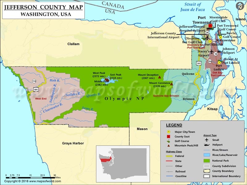
Covering an area of 2,183 square miles, Jefferson County is located in the Puget Sound region of the United States. Port Townsend is the county seat as well as the only incorporated city in Jefferson County. Established on December 22, 1852, the county is named after Thomas Jefferson, the third President of the US.
The Eastern portion of the county lies along the Strait of Juan de Fuca and Puget Sound. Its central, mountainous region, which remains largely uninhabited, lies mostly within Olympic National Park and the Olympic Peninsula. Western Jefferson County features small census towns along the Pacific Ocean.
The famous Hood Canal Bridge links the county with Kitsap County. U.S. Route 101, SR 20, and SR 104 are primary roads in the county. Port Townsend, a quaint Victorian seaport, is noted for many Victorian buildings in its Historic District.
More Maps of Jefferson County
- Jefferson County Map, Wisconsin
- Jefferson County Map, Nebraska
- Jefferson County Map, Alabama
- Jefferson County Map, Florida
- Jefferson County Map, New York
- Jefferson County Map, Texas
- Jefferson County Map, Tennessee
- Jefferson County Map, Georgia
Facts about Jefferson county in Washington |
|
|---|---|
| County Name | Jefferson county |
| Population | 30,228 |
| Founded | 22 December 1852 |
| Area | 2,183 sq mi (5,654 sq km) |
| Land Area | 1,804 sq mi (4,672 sq km) |
| Water Area | 379 sq mi (982 sq km), 17.4% |
| Largest City | Port Townsend |
| Cities | Port Townsend |
| County Seat | Port Townsend |
| Timezone | Pacific: UTC-8/-7 |
 Wall Maps