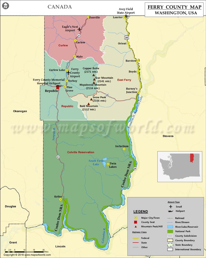
Check this Washington County Map to locate all the state’s counties in Washington Map.
Located in northeastern Washington, Ferry County was founded on February 21, 1899. Named after the state’s first governor Elisha P. Ferry, it is the fourth least populous county out of 39 counties in Washington. Covering an area of 2,257 square miles, the county features rugged mountain wilderness and has mining and logging industries. It borders the Canadian province of British Columbia to the north while the Columbia River marks most of its eastern boundary.
The county seat and the largest city is Republic. The Stonerose Interpretive Center in Republic features fossils discovered 50 million years ago. The county is home to Sherman Pass which remains open all year. The 123-acre Curlew Lake State Park offers visitors opportunities for camping, kayaking, and water skiing. State Route 20 and SR 21 are the main highways in Ferry County and both intersect in Republic.
Facts about Ferry county in Washington |
|
|---|---|
| County Name | Ferry county |
| Population | 7,667 |
| Founded | 21 February 1899 |
| Area | 2,257 sq mi (5,846 sq km) |
| Land Area | 2,203 sq mi (5,706 sq km) |
| Water Area | 54 sq mi (140 sq km), 2.4% |
| Largest City | Republic |
| Cities | Republic, Curlew, Keller, Malo, Washington, Orient, Washington, Danville, Washington, Laurier, Washington, Boyds |
| County Seat | Republic |
| Timezone | Pacific: UTC-8/-7 |
 Wall Maps