1.1K
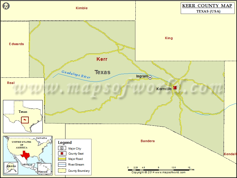
Check this Texas County Map to locate all the state’s counties in Texas Map.
Mountain Peaks in Kerr County
| Mountain Peak/Hill | Elevation [Meter] |
|---|---|
| Bachelor Mountain | 578 |
| Big Hill | 580 |
| Broad Mountain | 593 |
| Cloud Mountain | 586 |
| Fall Hill | 530 |
| Gobblers Knob | 676 |
| Haddenbrock Hill | 584 |
| Lookout Mountain | 542 |
| Mount Verde | 574 |
| Nanny Trap Mountain | 564 |
| Pikes Peak | 557 |
| Pointed Mountain | 581 |
| Red Hill | 679 |
| Round Top | 611 |
| State Mountain | 594 |
| Target Hill | 544 |
| Tivy Mountain | 578 |
| Twin Sisters | 533 |
| Wolkenburg | 589 |
Airports in Kerr County
| Airport Name |
|---|
| Apache Springs Airport |
| Barclay’s Roost Airport |
| Comanche Caves Ranch Airport |
| Comfort Airpark |
| Fall Creek Ranch Airport |
| Goebel Field |
| Indian Springs Ranch Airport |
| Kerrville Municipal Louis Schreiner Field |
| Lang Ranch Airport |
| Peterson Regional Medical Center Heliport |
| Priour Ranch Airport |
| Prison Canyon Ranch Airport |
| Santiago Cattle Co. Airport |
| Stowers Ranch Airport |
| Tierra Linda Ranch Airport |
| Vamc Heliport |
| West Kerr Ranch Airport |
| Y O Ranch Airport |
Cities in Kerr County
| City | Population | Latitude | Longitude |
|---|---|---|---|
| Ingram city | 1804 | 30.077304 | -99.238068 |
| Kerrville city | 22347 | 30.038503 | -99.13154 |
Golf Courses in Kerr County
| Name of Golf Course | Latitude | Longitude |
|---|---|---|
| Riverhill Country Club Inc-Kerrville | 30.023833 | -99.136801 |
| Scott Schriener Municipal Golf Course-Kerrville | 30.055785 | -99.130957 |
| The Club At Comanche Trace-Kerrville | 29.980887 | -99.110143 |
 Wall Maps