1.1K
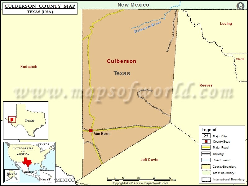
Check this Texas County Map to locate all the state’s counties in Texas Map.
Mountain Peaks in Culberson County
| Mountain Peak/Hill | Elevation [Meter] |
|---|---|
| Apache Peak | 1736 |
| Bartlett Peak | 2590 |
| Beach Mountains | 1761 |
| Bitter Well Mountain | 1569 |
| Black Peak | 1437 |
| Brushy Mesa | 1428 |
| Bush Mountain | 2626 |
| Castile Hill | 1174 |
| Cave Peak | 1530 |
| Cave Well Peak | 1293 |
| Chinaman Hat | 1401 |
| Chispa Mountain | 1574 |
| Cone Peak | 1515 |
| Cooky Hat Point | 1591 |
| Cow Mountain | 1206 |
| Coyote Peak | 2026 |
| Cutoff Mountain | 2114 |
| Dome Hill | 1411 |
| El Capitan | 2458 |
| Guadalupe Peak | 2664 |
| Heliograph Hill | 1530 |
| High Lonesome Peak | 1715 |
| Hunter Peak | 2517 |
| Iron Mountain | 1200 |
| Kent Mountain | 1408 |
| Lone Cone | 1340 |
| Loneman Mountain | 1365 |
| Lost Peak | 2383 |
| Nipple Hill | 1725 |
| North Mountain | 1571 |
| Old Baldy | 1522 |
| Owl Hills | 1082 |
| Pi±on Hills | 1672 |
| Quail Mountain | 1503 |
| Screw Bean Hills | 1106 |
| Seven L Peak | 1288 |
| Shumard Peak | 2621 |
| Spring Hill | 1503 |
| Square Mesa | 1509 |
| Sulfur Mine Hill | 1170 |
| Table Top | 1344 |
| The Chimneys | 1267 |
| Threemile Peak | 1479 |
| Tumbledown Mountain | 1780 |
| Victorio Peak | 1912 |
Airports in Culberson County
| Airport Name |
|---|
| Culberson County Airport |
| Figure 2 Ranch Airport |
| Triangle Ranch Private Airport |
Cities in Culberson County
| City | Population | Latitude | Longitude |
|---|---|---|---|
| Van Horn town | 2063 | 31.040672 | -104.834152 |
Golf Courses in Culberson County
| Name of Golf Course | Latitude | Longitude |
|---|---|---|
| Mountain View Golf Course-Van Horn | 31.03671 | -104.856029 |
National Parks in Culberson County
| Name of Park | Latitude | Longitude |
|---|---|---|
| Guadalupe Mountains NP | 31.923129 | -104.870824 |
| Guadalupe Mountains NP | 31.962595 | -104.747097 |
 Wall Maps