1.1K
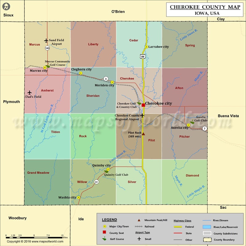
Mountain Peaks in Cherokee County
| Mountain Peak/Hill | Elevation [Meter] |
|---|---|
| Pilot Rock | 369 |
More Maps of Cherokee County
- Cherokee County Map, South Carolina
- Cherokee County Map, Alabama
- Cherokee County Map, North Carolina
- Cherokee County Map, Texas
- Cherokee County Map, Georgia
Airports in Cherokee County
| Airport Name |
|---|
| Cherokee County Regional Airport |
| Sand Field Airport |
| Willie’s Bomber Patch Airport |
Cities in Cherokee County
| City | Population | Latitude | Longitude |
|---|---|---|---|
| Aurelia city | 1036 | 42.713153 | -95.436529 |
| Cherokee city | 5253 | 42.751009 | -95.552854 |
| Cleghorn city | 240 | 42.811786 | -95.714126 |
| Larrabee city | 132 | 42.861571 | -95.54461 |
| Marcus city | 1117 | 42.822093 | -95.806564 |
| Meriden city | 159 | 42.794417 | -95.632996 |
| Quimby city | 319 | 42.62913 | -95.643863 |
| Washta city | 248 | 42.57545 | -95.719505 |
Golf Courses in Cherokee County
| Name of Golf Course | Latitude | Longitude |
|---|---|---|
| Aurelia Golf Club-Aurelia | 42.719307 | -95.427312 |
| Cherokee Golf & Country Club-Cherokee | 42.756025 | -95.564149 |
| Marcus Community Golf Course-Marcus | 42.82624 | -95.799389 |
| Quimby Golf Club-Quimby | 42.626271 | -95.648885 |
 Wall Maps