1.4K
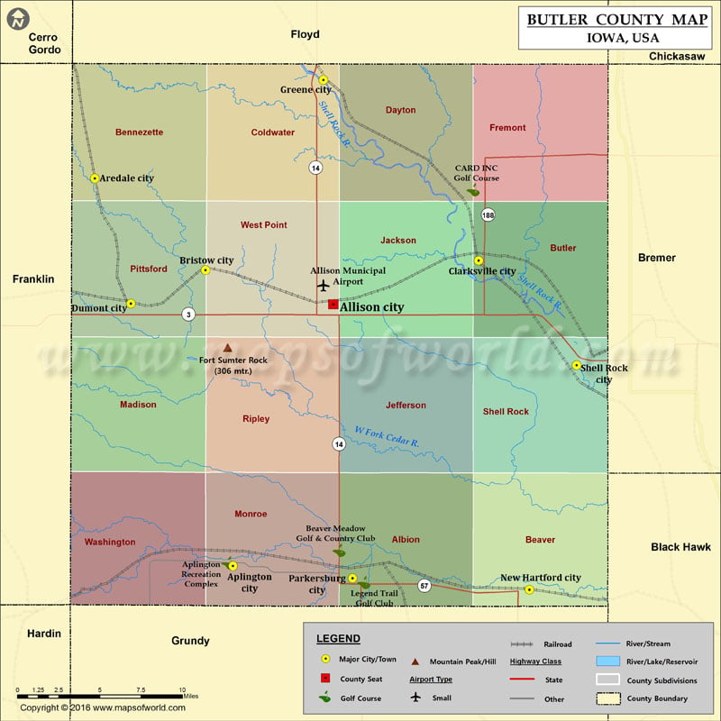
Mountain Peaks in Butler County
| Mountain Peak/Hill | Elevation [Meter] |
|---|---|
| Fort Sumter Rock | 306 |
More Maps of Butler County
Airports in Butler County
| Airport Name |
|---|
| Allison Municipal Airport |
Cities in Butler County
| City | Population | Latitude | Longitude |
|---|---|---|---|
| Allison city | 1029 | 42.751748 | -92.795761 |
| Aplington city | 1128 | 42.581981 | -92.88388 |
| Aredale city | 74 | 42.833196 | -93.005368 |
| Bristow city | 160 | 42.773824 | -92.907927 |
| Clarksville city | 1439 | 42.779987 | -92.668008 |
| Dumont city | 637 | 42.752193 | -92.973508 |
| Greene city | 1130 | 42.896909 | -92.804339 |
| New Hartford city | 516 | 42.566573 | -92.623215 |
| Parkersburg city | 1870 | 42.574 | -92.778795 |
| Shell Rock city | 1296 | 42.712234 | -92.581877 |
Golf Courses in Butler County
| Name of Golf Course | Latitude | Longitude |
|---|---|---|
| Aplington Recreation Complex-Aplington | 42.58396 | -92.887949 |
| Beaver Meadow Golf & Country Club-Parkersburg | 42.592175 | -92.790549 |
| CARD INC Golf Course-Clarksville | 42.82585 | -92.672599 |
| Legend Trail Golf Club-Parkersburg | 42.571264 | -92.768947 |
 Wall Maps