1.5K
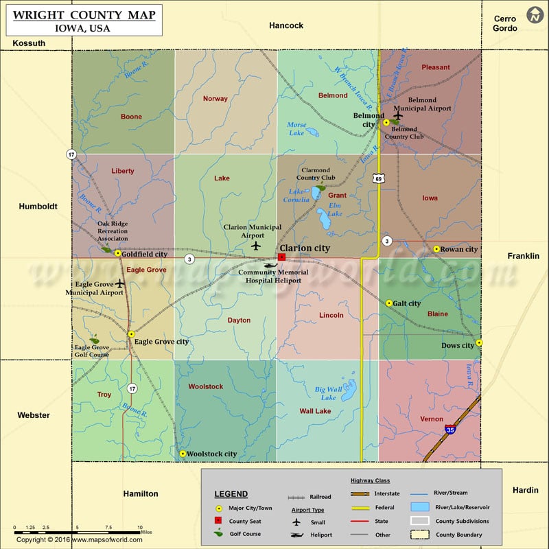
Airports in Wright County
| Airport Name |
|---|
| Belmond Municipal Airport |
| Clarion Municipal Airport |
| Community Memorial Hospital Heliport |
| Eagle Grove Municipal Airport |
Cities in Wright County
| City | Population | Latitude | Longitude |
|---|---|---|---|
| Belmond city | 2376 | 42.846574 | -93.60845 |
| Clarion city | 2850 | 42.732213 | -93.72936 |
| Dows city | 538 | 42.659285 | -93.50123 |
| Eagle Grove city | 3583 | 42.66672 | -93.902609 |
| Galt city | 32 | 42.692983 | -93.605127 |
| Goldfield city | 635 | 42.735641 | -93.918191 |
| Rowan city | 158 | 42.739117 | -93.550417 |
| Woolstock city | 168 | 42.564776 | -93.84326 |
Golf Courses in Wright County
| Name of Golf Course | Latitude | Longitude |
|---|---|---|
| Belmond Country Club-Belmond | 42.848907 | -93.59897 |
| Clarmond Country Club-Clarion | 42.79275 | -93.684116 |
| Eagle Grove Golf Course-Eagle Grove | 42.662622 | -93.945329 |
| Oak Ridge Recreation Associaton-Goldfield | 42.74014 | -93.931834 |
 Wall Maps