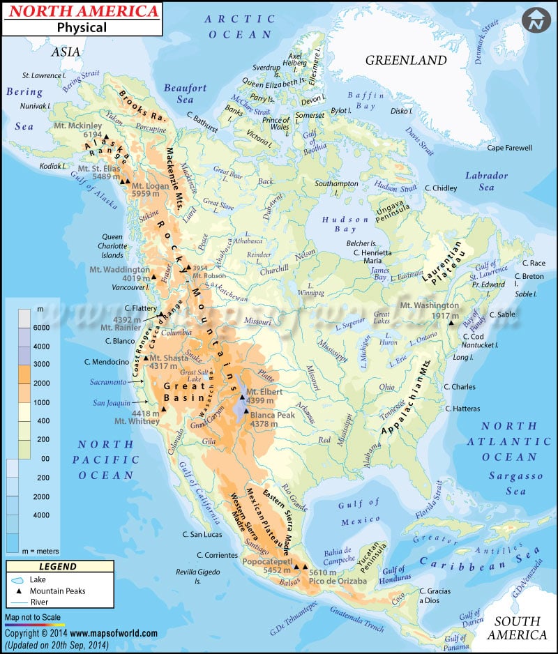
Physical maps of North American Countries
North America is the third largest continent of the world. It is roughly wedge shaped and is broadest in the northern part. Maximum area of North America lies in the middle latitudes
Its east-west extent is around 176° of latitudes (12°W to 176°E) and north-south extent is 69° of longitudes (83°N to 14°N). It is surrounded by Arctic Ocean in the north, Atlantic Ocean in the east, Pacific Ocean in the west and the Gulf of Mexico on the south.
North America can be divided into 4 major natural regions (each of which contains many sub-regions). The highest point of North America is Denali Peak in Alaska.
The major physical regions are:
1. The
Great Plains stretching from Gulf of Mexico to the Canadian Arctic.
2. The
Western Mountains including Rocky Mountains, the Great Basin (a lower area containing smaller ranges and low-lying deserts), California and Alaska.
3. The
Canadian Shield (or Laurentian Plateau) which is a plateau region underlain by ancient crystalline rocks.
4. Varied
Eastern Region that includes Appalachian Mountains, Coastal Plain along the Atlantic seaboard, Florida Peninsular, etc.
The drainage system of North America can be divided into: -
1. The
Great Lakes-St. Lawrence River System that drains the northern part of the North America.
2.
Mississippi-Missouri River System that drains the central as well as the southern section and is the lifeline of the Great Plains.
3.
Mackenzie River System of the Western Canada.


